iFANN
    Search iFANN...
    Log in
    Home
    News
    Videos
    Photos
    GIFs
    Explore
    Polls
    Awards
    iFAMOUS
    Wiki
    Anime
    Rooms
    Notifications
    Messages
    Bookmarks
    Profile
    WikiAwardsiFAMOUSRankingsIndustriesCreator RewardsUser RewardsTermsPrivacyCommunity GuidelinesTakedown / DMCAHelpDevelopers

    © 2026 iFANN

    Home
    Search
    Messages
    Alerts
    Profile
    Photo
    Not A Newt
    Not A Newt@not_a_newt1w
    💭Middle East💭Viral News
    Houthis control Bab el-Mandeb Strait map

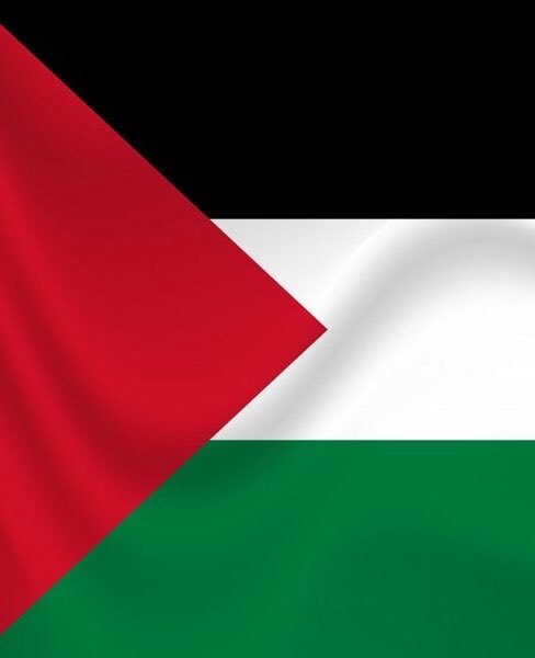
    @not_a_newtthe opposing Yemeni group backed by the Saudi government just announced they are pulling out of Perim Island and the Bab el-Mandeb Strait. that move hands complete control of the shipping corridor leading to the Suez Canal over to Houthi forces who have been advancing along the Red Sea coast. this shift means the Houthis now manage a chokepoint handling roughly 30% of global container traffic plus an alternative route for Saudi energy. looking at the geography, the Bab el-Mandeb Strait is only about 20km wide with a narrow path where you can spot the other side if the weather holds up.

    View original post
    Houthis control Bab el-Mandeb Strait map

    Photo by @not_a_newt· Sep 11, 2026· Middle East

    About this photo

    The image is a screenshot of a map, likely from a navigation app. It focuses on the Horn of Africa and the Arabian Peninsula, specifically highlighting Djibouti and the surrounding waters. A red circle encloses Djibouti, and a red arrow points from Djibouti towards Perim Island. The mood is informational and geographical. A notable detail is the scale bar at the bottom left indicating "22,326 km". ON-SCREEN TEXT: Djibouti, Perim Island, Jazirat Ma'un, Fagal, Khôr 'Angar.

    See all Middle East photos

    ?

    More Middle East photos

    See all Middle East photos
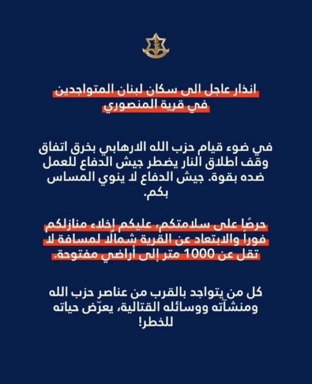
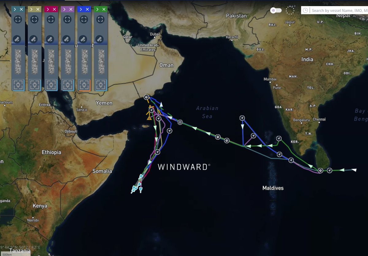
    Macklemore Palestine donation2Macklemore Palestine donationMiddle East University Counts 2026Middle East University Counts 2026Middle East Oil Production RankingMiddle East Oil Production RankingDubai International Airport EmiratesDubai International Airport EmiratesUAE Ministry Foreign Affairs joint condemnationUAE Ministry Foreign Affairs joint condemnationIran warns Syria over Lebanon invasion2Iran warns Syria over Lebanon invasionEhab Diab Gaza detainee deathEhab Diab Gaza detainee deathBrandon Weichert on Iran and the Crassus parallelBrandon Weichert on Iran and the Crassus parallelGaza Strip rubble and tents2Gaza Strip rubble and tentsTrump new Middle East order4Trump new Middle East orderIDF evacuation warning for MansouriIDF evacuation warning for MansouriIDF evacuation alert Mansouri southern Lebanon3IDF evacuation alert Mansouri southern LebanonHamas ceasefire disarmament stance2Hamas ceasefire disarmament stanceSaudi supertankers reroute around AfricaSaudi supertankers reroute around AfricaHouthi strike on Aramco Jazan refinery3Houthi strike on Aramco Jazan refinerySaudi Aramco Jazan refinery shutdown Houthi attack2Saudi Aramco Jazan refinery shutdown Houthi attackMiddle East GDP per Capita 2026Middle East GDP per Capita 2026Pew Research unfavorable views of Israel 2025Pew Research unfavorable views of Israel 2025
    Photo
    Not A Newt
    Not A Newt@not_a_newt1w
    💭Middle East💭Viral News
    Houthis control Bab el-Mandeb Strait map

    @not_a_newtthe opposing Yemeni group backed by the Saudi government just announced they are pulling out of Perim Island and the Bab el-Mandeb Strait. that move hands complete control of the shipping corridor leading to the Suez Canal over to Houthi forces who have been advancing along the Red Sea coast. this shift means the Houthis now manage a chokepoint handling roughly 30% of global container traffic plus an alternative route for Saudi energy. looking at the geography, the Bab el-Mandeb Strait is only about 20km wide with a narrow path where you can spot the other side if the weather holds up.

    View original post
    Houthis control Bab el-Mandeb Strait map

    Photo by @not_a_newt· Sep 11, 2026· Middle East

    About this photo

    The image is a screenshot of a map, likely from a navigation app. It focuses on the Horn of Africa and the Arabian Peninsula, specifically highlighting Djibouti and the surrounding waters. A red circle encloses Djibouti, and a red arrow points from Djibouti towards Perim Island. The mood is informational and geographical. A notable detail is the scale bar at the bottom left indicating "22,326 km". ON-SCREEN TEXT: Djibouti, Perim Island, Jazirat Ma'un, Fagal, Khôr 'Angar.

    See all Middle East photos

    ?

    More Middle East photos

    See all Middle East photos
    Macklemore Palestine donation2Macklemore Palestine donationMiddle East University Counts 2026Middle East University Counts 2026Middle East Oil Production RankingMiddle East Oil Production RankingDubai International Airport EmiratesDubai International Airport EmiratesUAE Ministry Foreign Affairs joint condemnationUAE Ministry Foreign Affairs joint condemnationIran warns Syria over Lebanon invasion2Iran warns Syria over Lebanon invasionEhab Diab Gaza detainee deathEhab Diab Gaza detainee deathBrandon Weichert on Iran and the Crassus parallelBrandon Weichert on Iran and the Crassus parallelGaza Strip rubble and tents2Gaza Strip rubble and tentsTrump new Middle East order4Trump new Middle East orderIDF evacuation warning for MansouriIDF evacuation warning for MansouriIDF evacuation alert Mansouri southern Lebanon3IDF evacuation alert Mansouri southern LebanonHamas ceasefire disarmament stance2Hamas ceasefire disarmament stanceSaudi supertankers reroute around AfricaSaudi supertankers reroute around AfricaHouthi strike on Aramco Jazan refinery3Houthi strike on Aramco Jazan refinerySaudi Aramco Jazan refinery shutdown Houthi attack2Saudi Aramco Jazan refinery shutdown Houthi attackMiddle East GDP per Capita 2026Middle East GDP per Capita 2026Pew Research unfavorable views of Israel 2025Pew Research unfavorable views of Israel 2025