
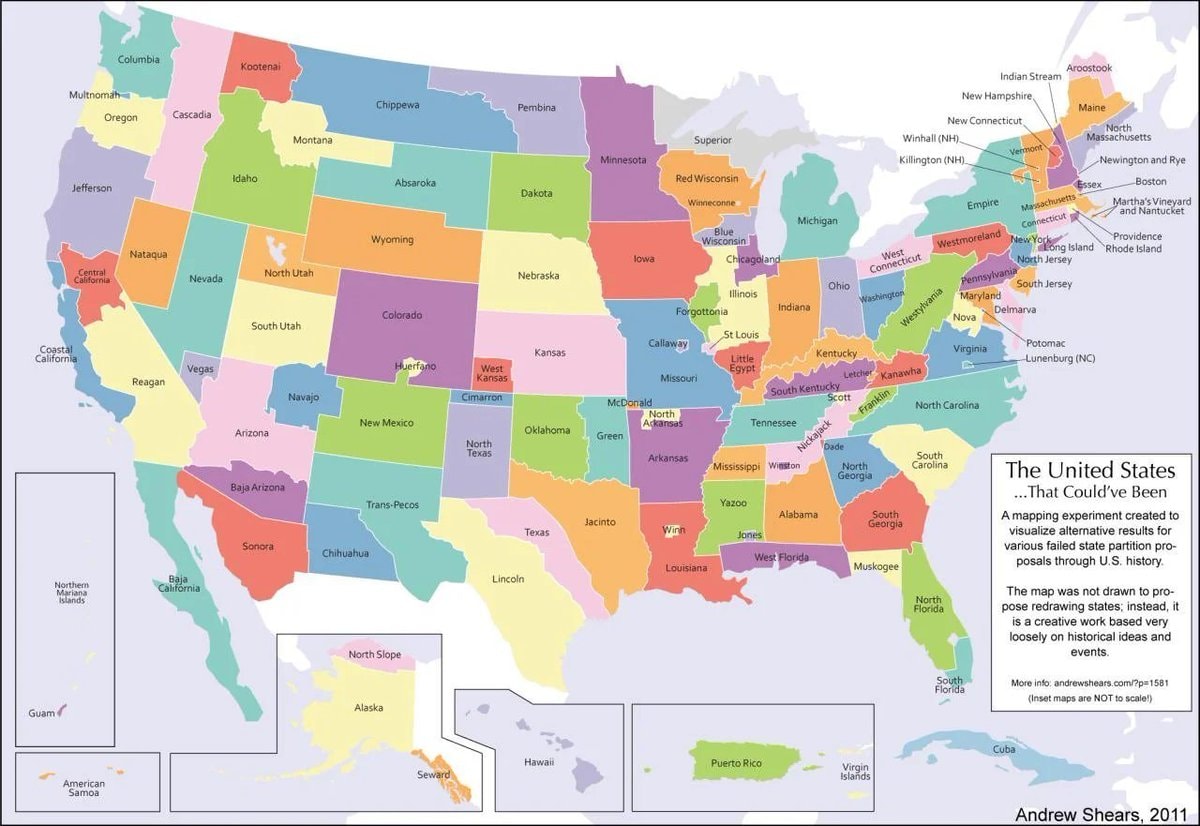
@scarlett_sThe 124 United States That Could’ve Been. #UnitedStates
View original post@scarlett_sThe 124 United States That Could’ve Been. #UnitedStates
View original postPhoto by @scarlett_s· Oct 16, 2026· United States
The image is a colorful, stylized map of the United States. It depicts an alternate history where states have been redrawn into different shapes and given new names. The mood is educational and thought-provoking, presented in a clean, infographic style. A notable detail is the text box in the lower right corner, which explains the map's purpose. ON-SCREEN TEXT: The United States ...That Could've Been A mapping experiment created to visualize alternative results for various failed state partition proposals through U.S. history. The map was not drawn to propose redrawing states; instead, it is a creative work based very loosely on historical ideas and events. More info: andrewshears.com/?p=1581 (Inset maps are NOT to scale!) Andrew Shears, 2011
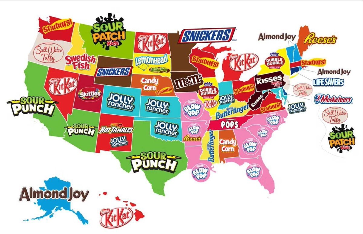 most popular candy by U.S. State
 2ERO ONE ICE surveillance plan
 2Trump on Canada becoming the 51st state
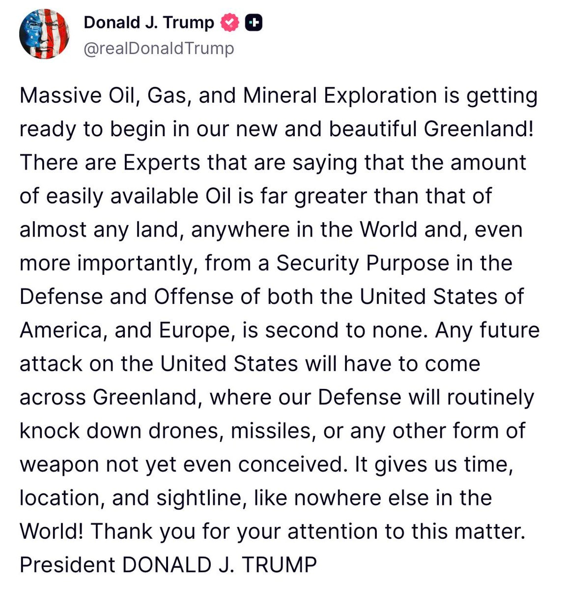 Trump on Greenland resources
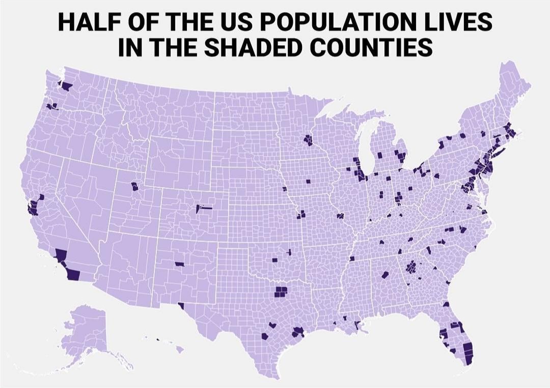 us population distribution by counties
 Jorge Rodríguez sanctions lifted
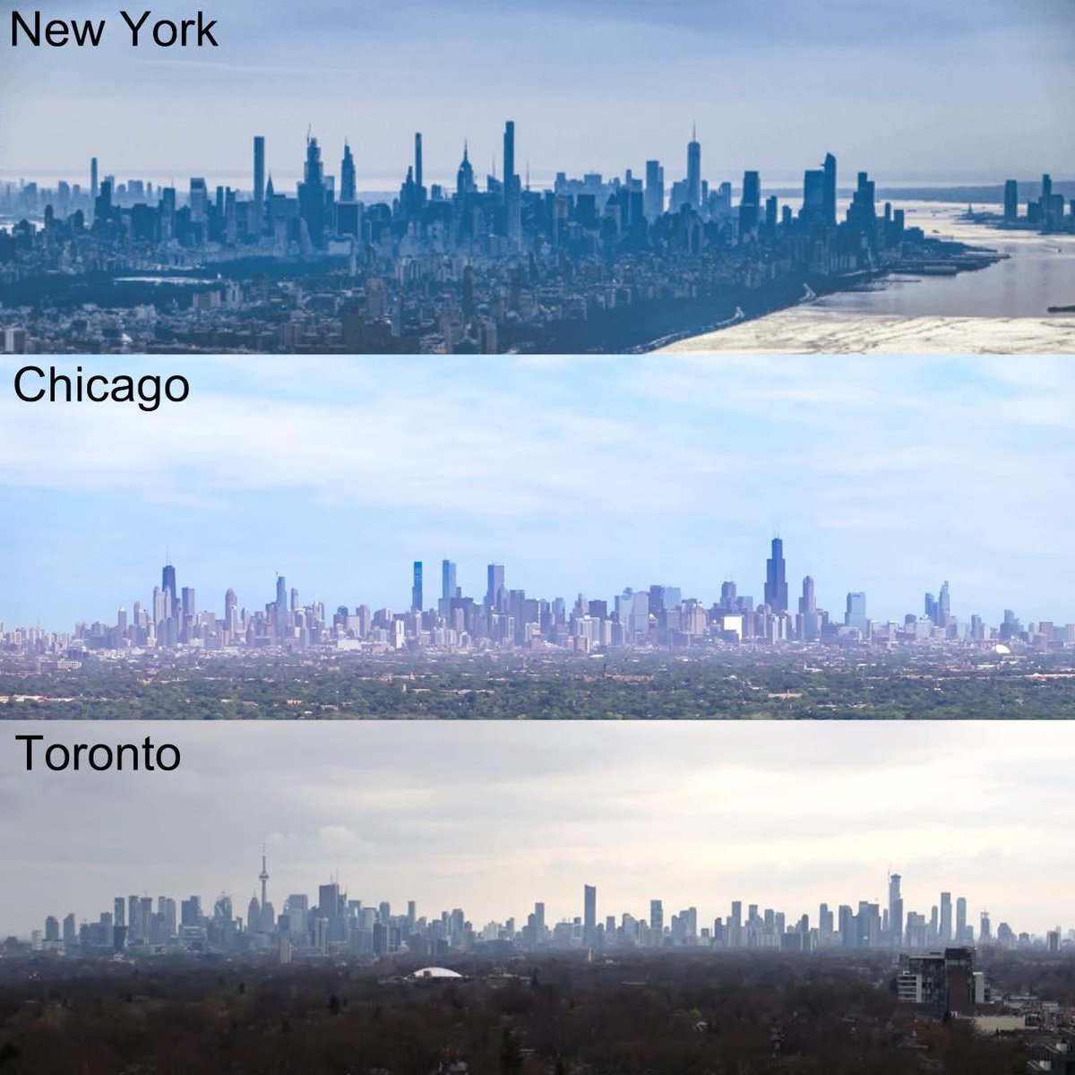 North America's three major skylines
 FRN FRONT POUR LA REFONDATION DE LA NATION pin
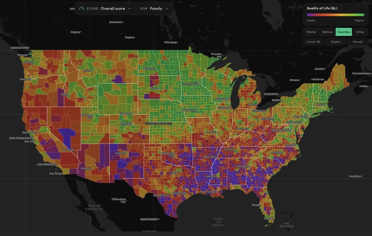 US counties family quality of life map
 Peter Alexander Z-Ben Advisors EV costs
 Olivier Giroud leaves MLS for Lille
 Waikiki beach Hawaii
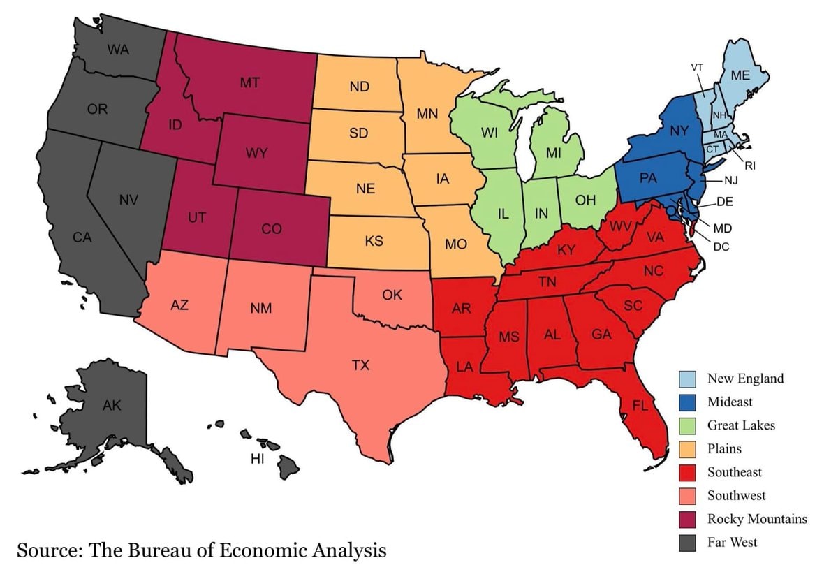 Official BEA Regions of the U.S.
 2US alcohol consumption trends
 MLS vs Saudi League career choice
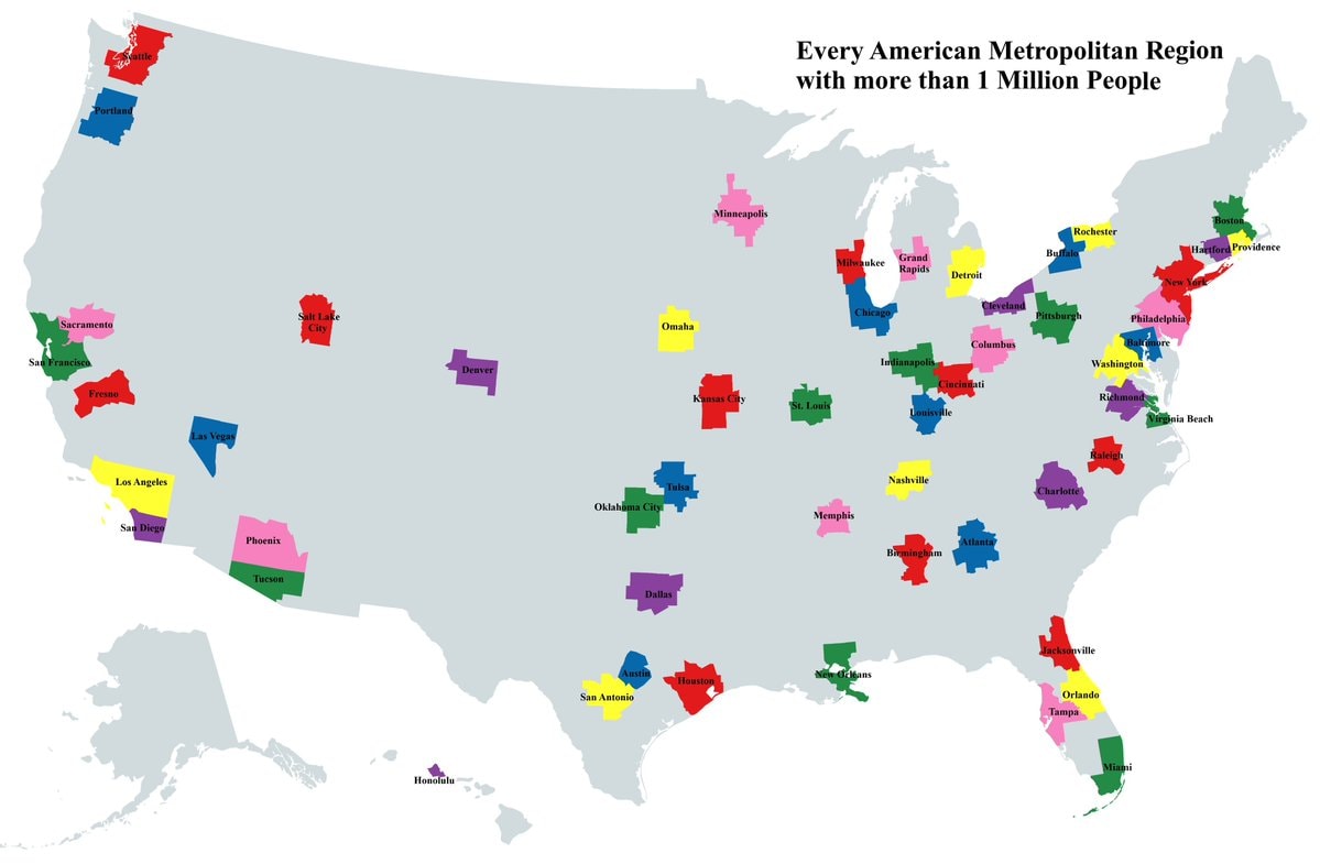 U.S. Metro Areas Over 1 Million
 Trump Greenland deal handshake
 2US mortgage rates at 7.4%
@scarlett_sThe 124 United States That Could’ve Been. #UnitedStates
View original postPhoto by @scarlett_s· Oct 16, 2026· United States
The image is a colorful, stylized map of the United States. It depicts an alternate history where states have been redrawn into different shapes and given new names. The mood is educational and thought-provoking, presented in a clean, infographic style. A notable detail is the text box in the lower right corner, which explains the map's purpose. ON-SCREEN TEXT: The United States ...That Could've Been A mapping experiment created to visualize alternative results for various failed state partition proposals through U.S. history. The map was not drawn to propose redrawing states; instead, it is a creative work based very loosely on historical ideas and events. More info: andrewshears.com/?p=1581 (Inset maps are NOT to scale!) Andrew Shears, 2011
No comments yet. Be the first!
most popular candy by U.S. State2ERO ONE ICE surveillance plan2Trump on Canada becoming the 51st stateTrump on Greenland resourcesus population distribution by countiesJorge Rodríguez sanctions liftedNorth America's three major skylinesFRN FRONT POUR LA REFONDATION DE LA NATION pinUS counties family quality of life mapPeter Alexander Z-Ben Advisors EV costsOlivier Giroud leaves MLS for LilleWaikiki beach HawaiiOfficial BEA Regions of the U.S.2US alcohol consumption trendsMLS vs Saudi League career choiceU.S. Metro Areas Over 1 MillionTrump Greenland deal handshake2US mortgage rates at 7.4%
No comments yet. Be the first!