@scarlett_sEvaluating a map of Europe from 814 for accuracy
View original post@scarlett_sEvaluating a map of Europe from 814 for accuracy
View original postPhoto by @scarlett_s· Oct 13, 2026· Charlemagne
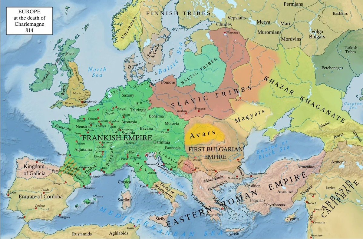
The image is a historical map of Europe. It shows the political divisions of the continent in 814 AD, at the death of Charlemagne. The map is colored to distinguish different empires and tribal territories, with labels for regions like the Frankish Empire, the Roman Empire, the Khazar Khaganate, and various Slavic, Baltic, and Norse tribes. The style is informative and educational, typical of historical atlases or textbooks. A notable detail is the clear depiction of major rivers and cities of the era. The title in the upper left corner reads "EUROPE at the death of Charlemagne 814".
@scarlett_sEvaluating a map of Europe from 814 for accuracy
View original postPhoto by @scarlett_s· Oct 13, 2026· Charlemagne
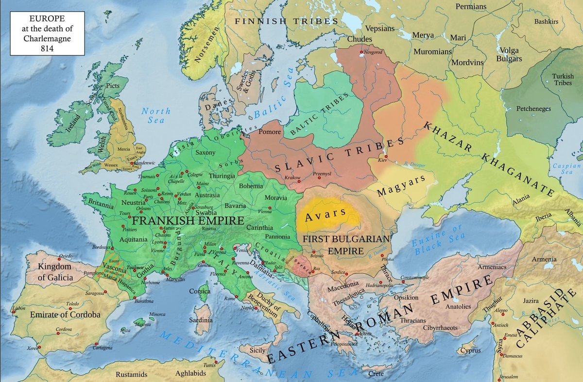
The image is a historical map of Europe. It shows the political divisions of the continent in 814 AD, at the death of Charlemagne. The map is colored to distinguish different empires and tribal territories, with labels for regions like the Frankish Empire, the Roman Empire, the Khazar Khaganate, and various Slavic, Baltic, and Norse tribes. The style is informative and educational, typical of historical atlases or textbooks. A notable detail is the clear depiction of major rivers and cities of the era. The title in the upper left corner reads "EUROPE at the death of Charlemagne 814".