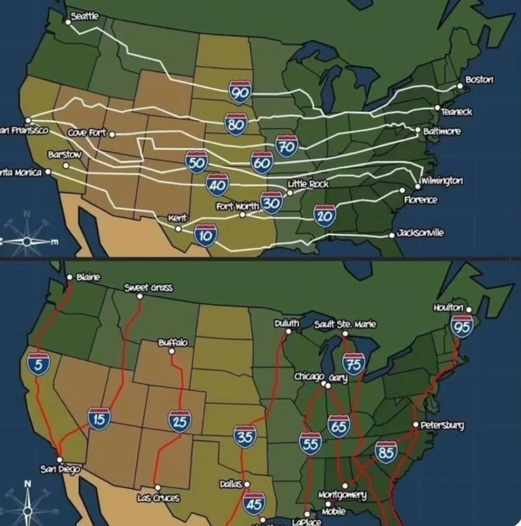
@scarlett_sHere's how the numbering system for US Interstates actually works
View original post@scarlett_sHere's how the numbering system for US Interstates actually works
View original postPhoto by @scarlett_s· Oct 28, 2026· United States
The image is a cartoon map of the United States divided into two sections. The top section shows major east-west interstate highways labeled with their numbers and some city names. The bottom section shows major north-south interstate highways, also labeled with numbers and cities. The style is illustrative and informational, like a diagram. The contrast between the two maps highlights different travel routes across the country.
 2Flávio Bolsonaro leaves Brazil
 Flavio Bolsonaro whereabouts unknown
 2Flávio Bolsonaro US travel allegation
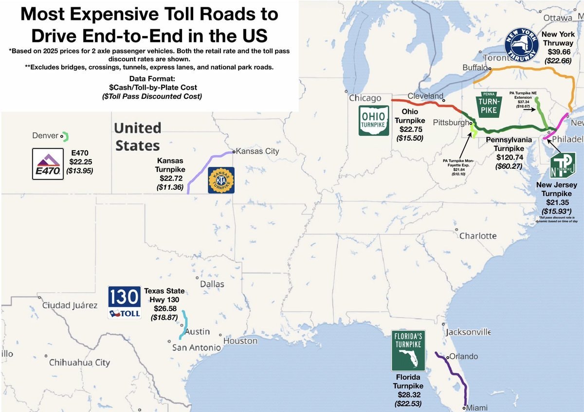 most expensive US toll roads map
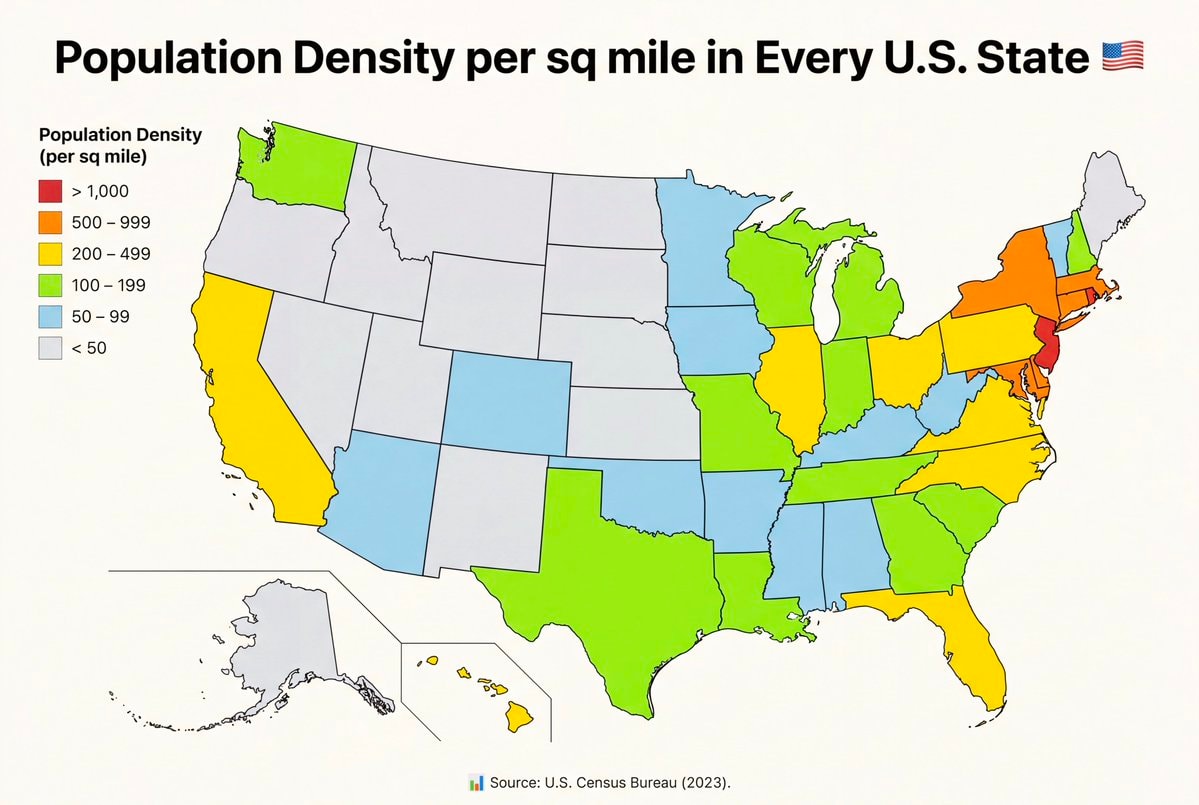 U.S. State population density per square mile
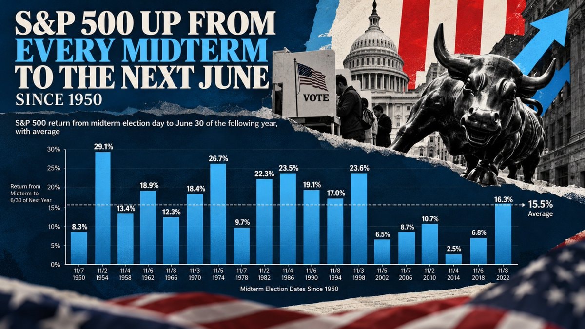 S&P 500 midterm election gains since 1950
 4NICU Halloween costumes US
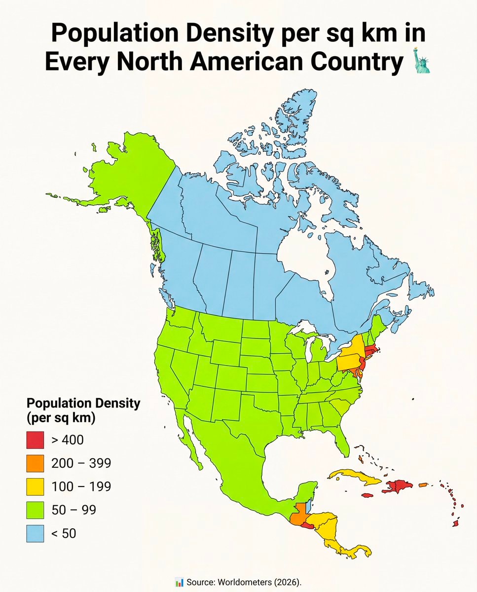 North America population density map
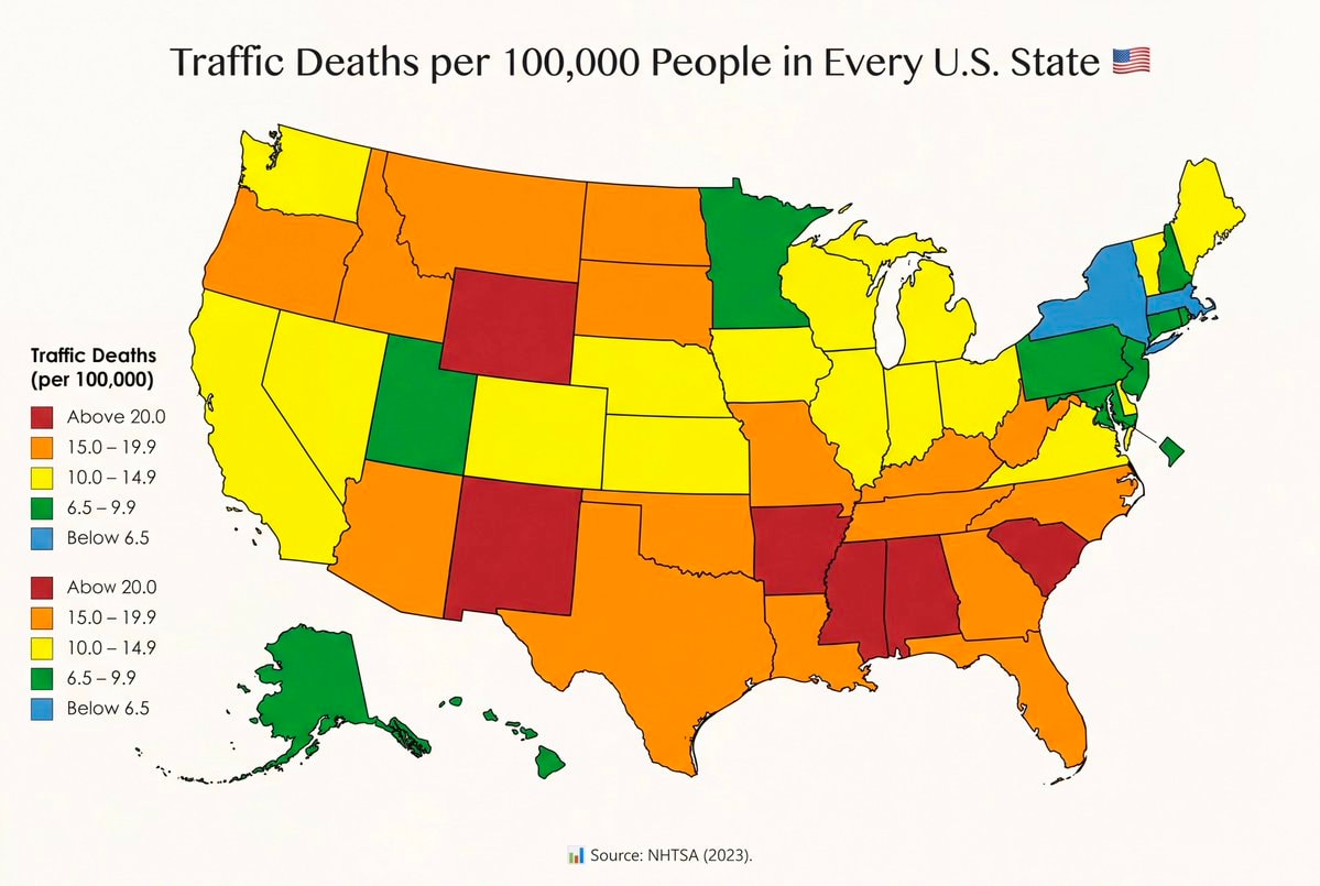 Traffic fatality rates by U.S. State
 US Iran strike tension
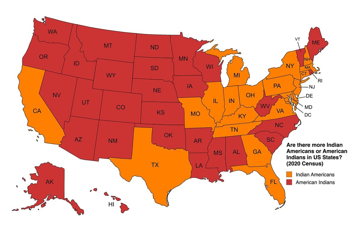 Indian Americans vs American Indians by US state
 AOC on a past gay US President
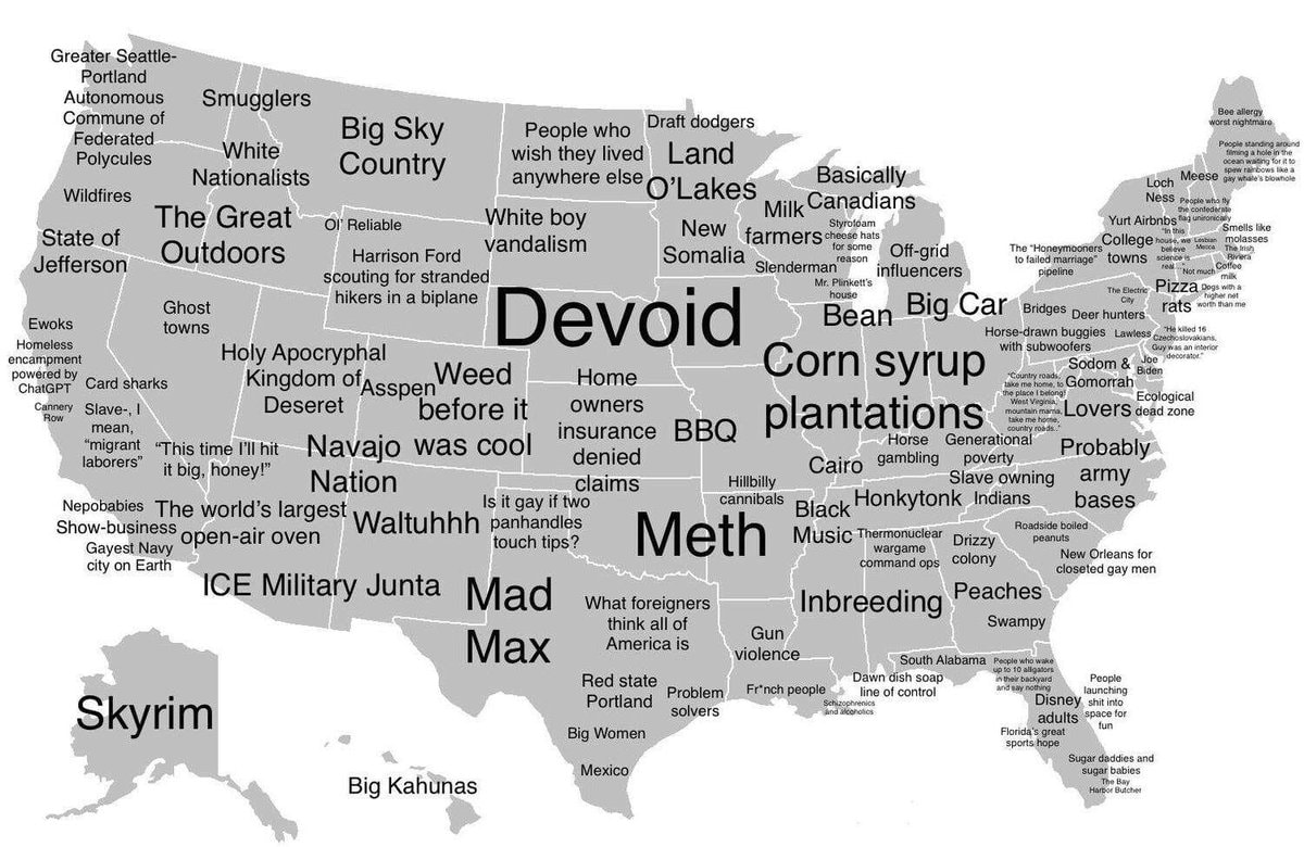 How Americans see America map
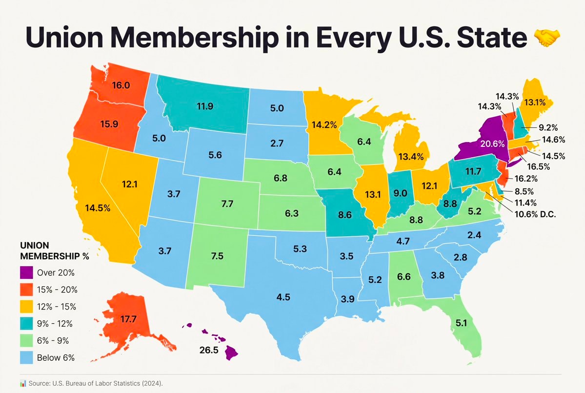 Union Membership by U.S. State
 2US citizenship grants drop 72% in 2026
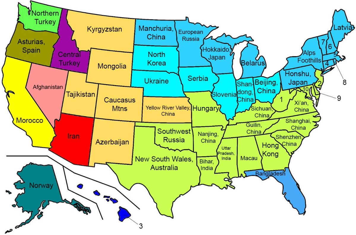 US states with similar climates worldwide
 2Halloween candy prices up 44%
 Zelensky on Ukraine US relations and peace
@scarlett_sHere's how the numbering system for US Interstates actually works
View original postPhoto by @scarlett_s· Oct 28, 2026· United States
The image is a cartoon map of the United States divided into two sections. The top section shows major east-west interstate highways labeled with their numbers and some city names. The bottom section shows major north-south interstate highways, also labeled with numbers and cities. The style is illustrative and informational, like a diagram. The contrast between the two maps highlights different travel routes across the country.
No comments yet. Be the first!
2Flávio Bolsonaro leaves BrazilFlavio Bolsonaro whereabouts unknown2Flávio Bolsonaro US travel allegationmost expensive US toll roads mapU.S. State population density per square mileS&P 500 midterm election gains since 19504NICU Halloween costumes USNorth America population density mapTraffic fatality rates by U.S. StateUS Iran strike tensionIndian Americans vs American Indians by US stateAOC on a past gay US PresidentHow Americans see America mapUnion Membership by U.S. State2US citizenship grants drop 72% in 2026US states with similar climates worldwide2Halloween candy prices up 44%Zelensky on Ukraine US relations and peace
No comments yet. Be the first!