
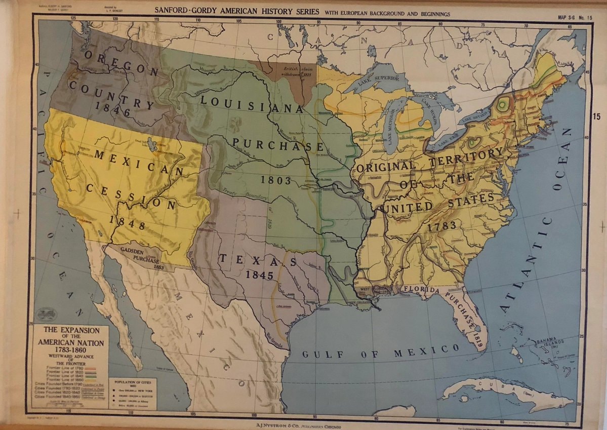
@scarlett_sA long read on how the United States expanded between 1783, 1860
View original post@scarlett_sA long read on how the United States expanded between 1783, 1860
View original postPhoto by @scarlett_s· Sep 24, 2026· United States
The image is a historical map of the United States. It depicts territorial expansion with different colored regions labeled with purchases and annexations like the Louisiana Purchase, Mexican Cession, and Texas 1845. The map has a vintage educational style. Notable details include the various dates associated with each territorial acquisition and the detailed labeling of geographical features and boundaries. ON-SCREEN TEXT: SANFORD-GORDY AMERICAN HISTORY SERIES WITH EUROPEAN BACKGROUND AND BEGINNINGS MAP S-G No. 15 THE EXPANSION OF THE AMERICAN NATION 1783-1860 WESTWARD ADVANCE THE FRONTIER Frontier Line of 1790 Frontier Line of 1820 Frontier Line of 1850 Frontier Line of 1860 Cities Founded Before 1790 Cities Founded 1790-1840 Cities Founded 1840-1860 POPULATION OF CITIES 1860 OVER 100,000 NEW YORK 50,0
 European flags in other styles
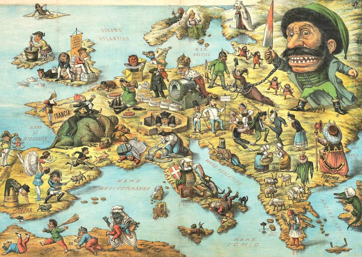 Satirical map of Europe 1871
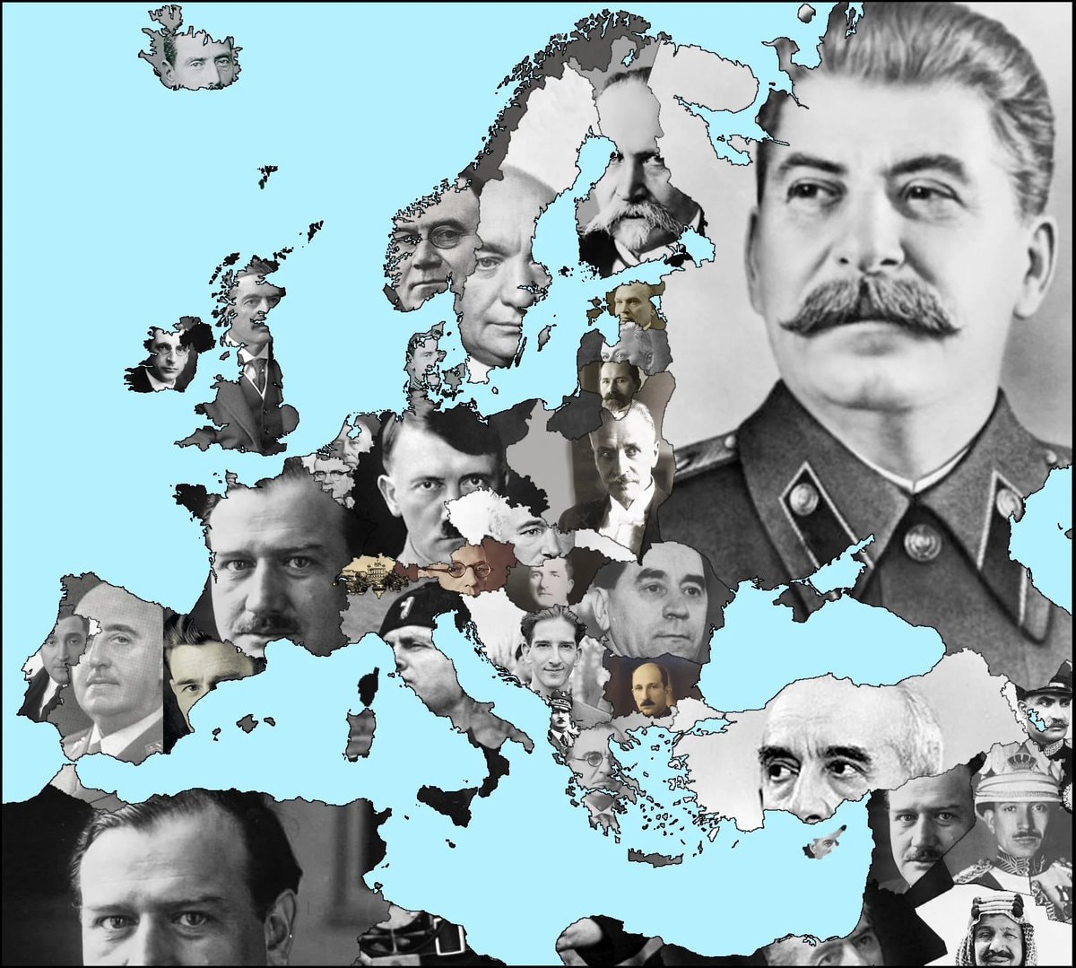 Europe leaders 1930s
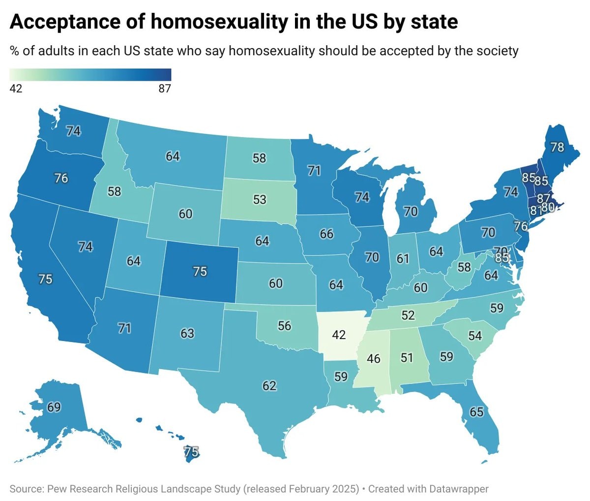 homosexuality acceptance by U.S. state
 Penn Station NYC 1910 vs Today
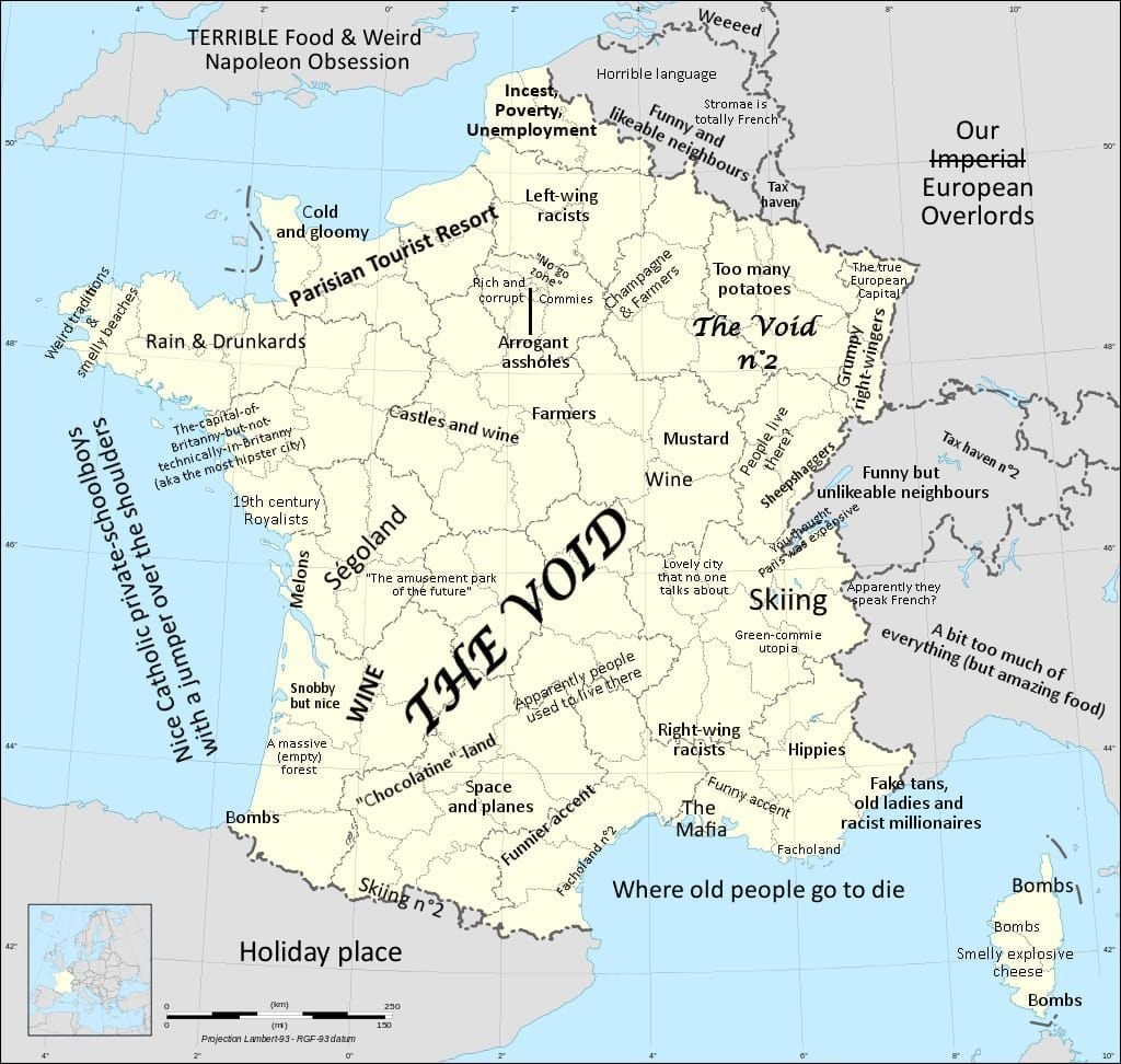 France regional stereotypes map
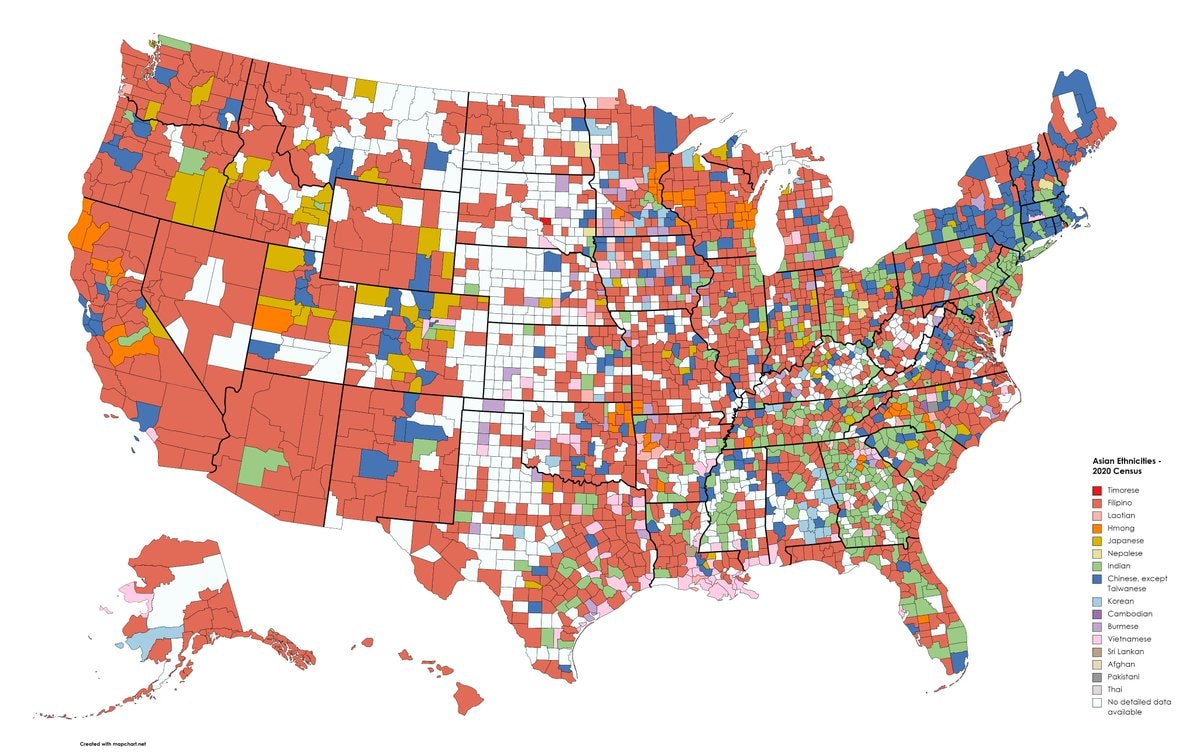 U.S. counties by largest Asian ethnicity
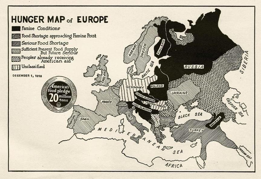 Hunger Map of Europe 1918
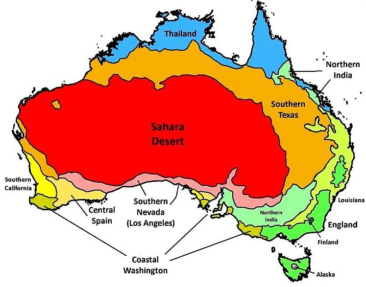 Australia climate zones vs the world
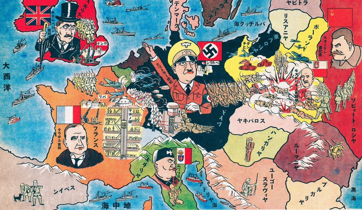 Japanese map of Europe 1939
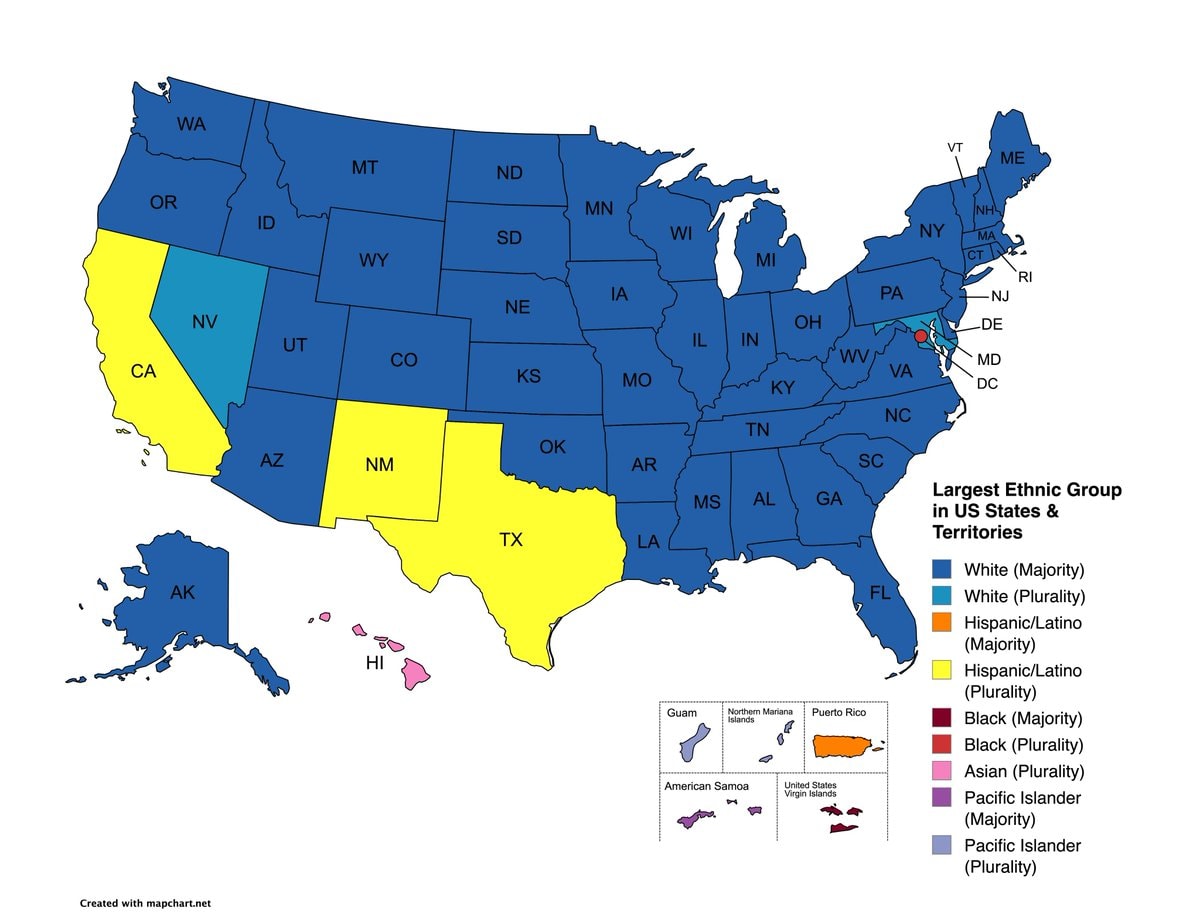 Largest ethnic group by US state map
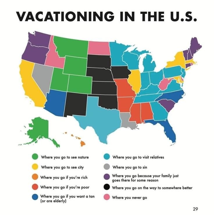 U.S. vacation map
 Sagrada Família 1905 vs Today
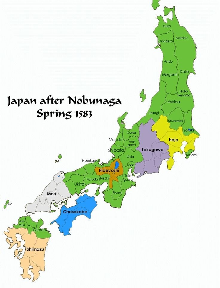 Japan spring 1583 map
 Europe in 1154
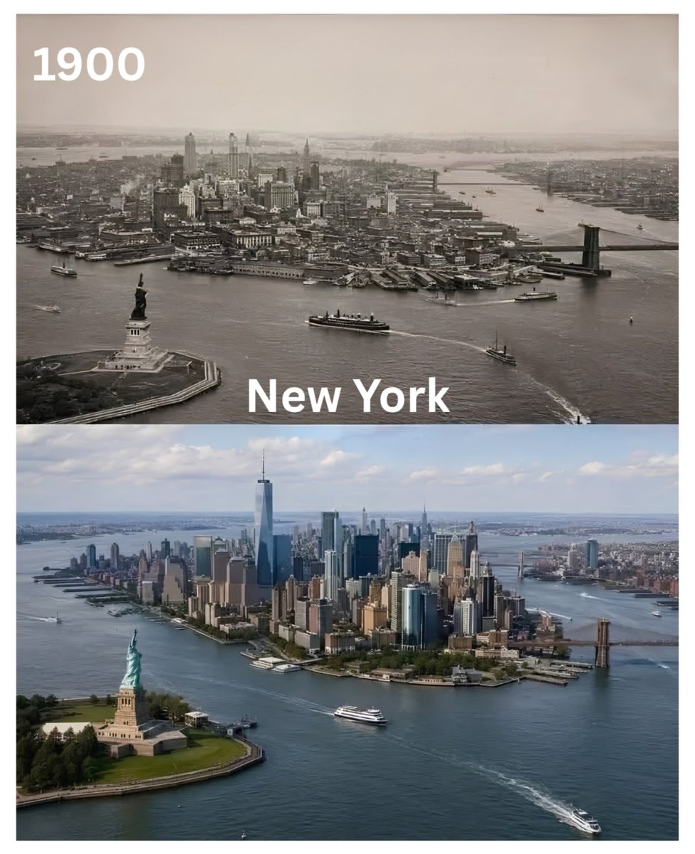 New York 1900s vs today
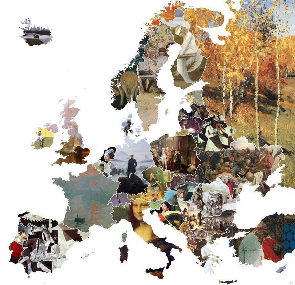 Europe map famous artworks
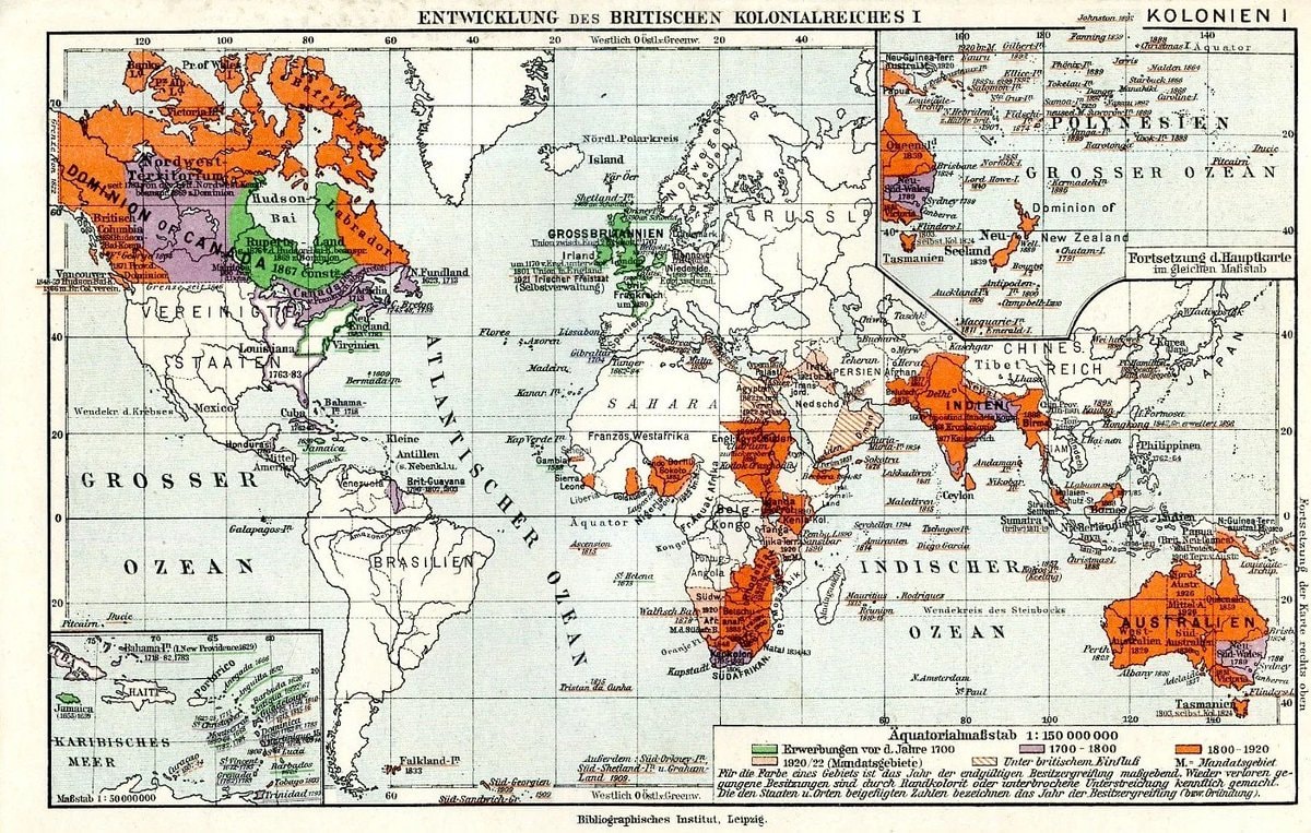 British Empire expansion map
@scarlett_sA long read on how the United States expanded between 1783, 1860
View original postPhoto by @scarlett_s· Sep 24, 2026· United States
The image is a historical map of the United States. It depicts territorial expansion with different colored regions labeled with purchases and annexations like the Louisiana Purchase, Mexican Cession, and Texas 1845. The map has a vintage educational style. Notable details include the various dates associated with each territorial acquisition and the detailed labeling of geographical features and boundaries. ON-SCREEN TEXT: SANFORD-GORDY AMERICAN HISTORY SERIES WITH EUROPEAN BACKGROUND AND BEGINNINGS MAP S-G No. 15 THE EXPANSION OF THE AMERICAN NATION 1783-1860 WESTWARD ADVANCE THE FRONTIER Frontier Line of 1790 Frontier Line of 1820 Frontier Line of 1850 Frontier Line of 1860 Cities Founded Before 1790 Cities Founded 1790-1840 Cities Founded 1840-1860 POPULATION OF CITIES 1860 OVER 100,000 NEW YORK 50,0
No comments yet. Be the first!
European flags in other stylesSatirical map of Europe 1871Europe leaders 1930shomosexuality acceptance by U.S. statePenn Station NYC 1910 vs TodayFrance regional stereotypes mapU.S. counties by largest Asian ethnicityHunger Map of Europe 1918Australia climate zones vs the worldJapanese map of Europe 1939Largest ethnic group by US state mapU.S. vacation mapSagrada Família 1905 vs TodayJapan spring 1583 mapEurope in 1154New York 1900s vs todayEurope map famous artworksBritish Empire expansion map
No comments yet. Be the first!