
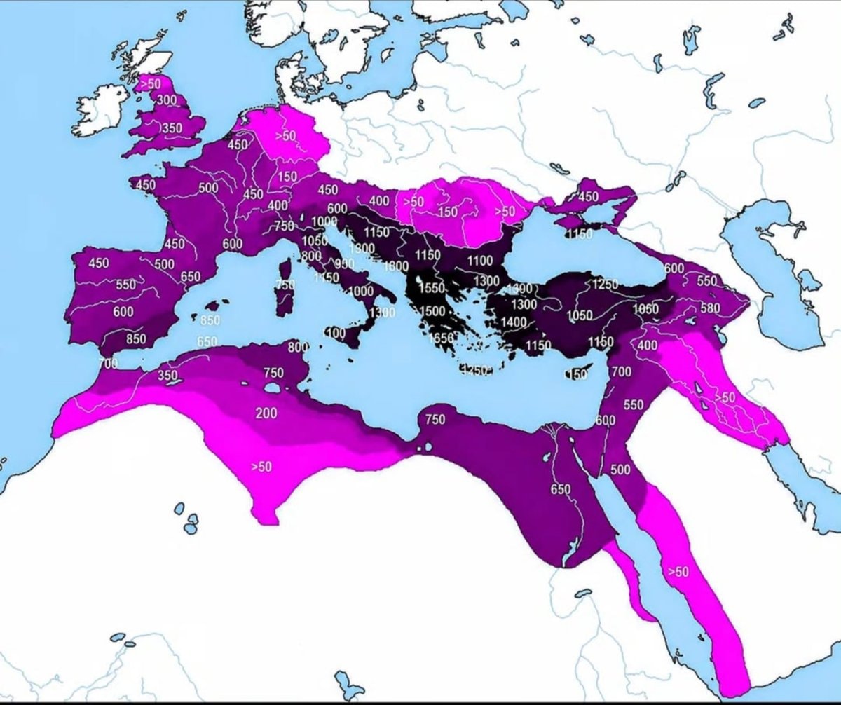
@taikiRoman Empire organized by years of control with data broken down by region
View original post@taikiRoman Empire organized by years of control with data broken down by region
View original postPhoto by @taiki· Sep 14, 2026· Info/Editorials
The image is a historical map showing the extent of the Roman Empire and its successor states across Europe, North Africa, and the Middle East. Different shades of purple indicate varying periods of control or influence, with numerical labels representing years. The map's style is educational and informative, with clear borders and numerical data overlaid on geographical features. The most notable visual element is the extensive territorial coverage depicted by the purple shading, highlighting the vast reach of Roman influence throughout history.
 Most spoken language in Mexico
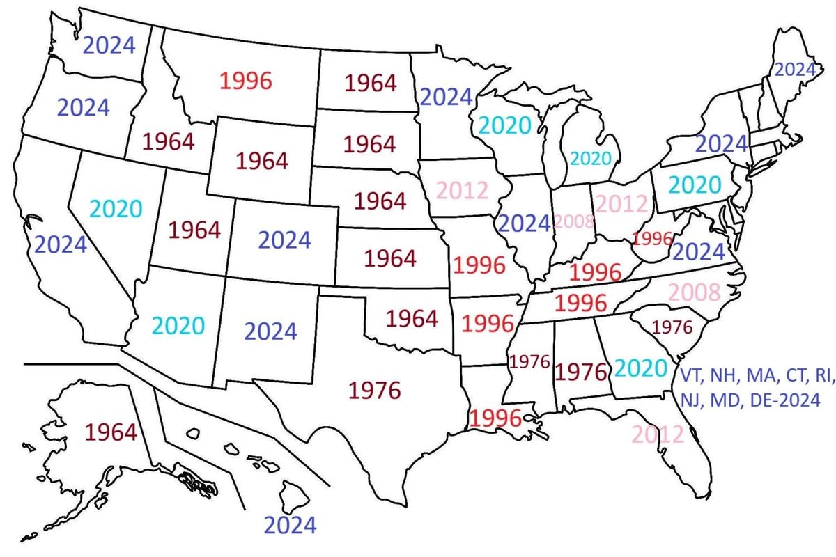 U.S. states last vote for Democrat
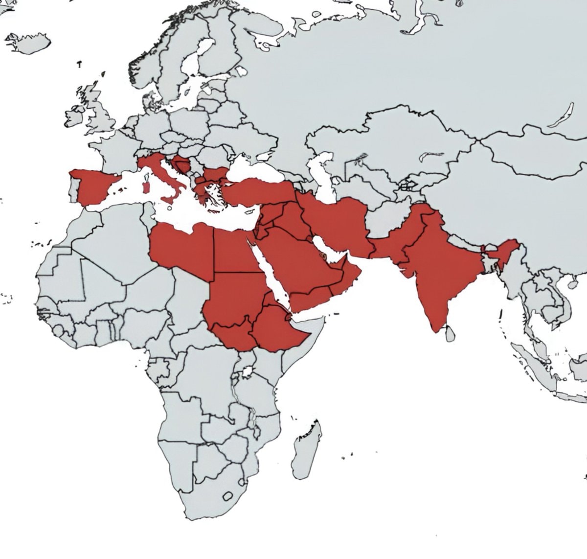 Nations Mentioned in the Holy Bible
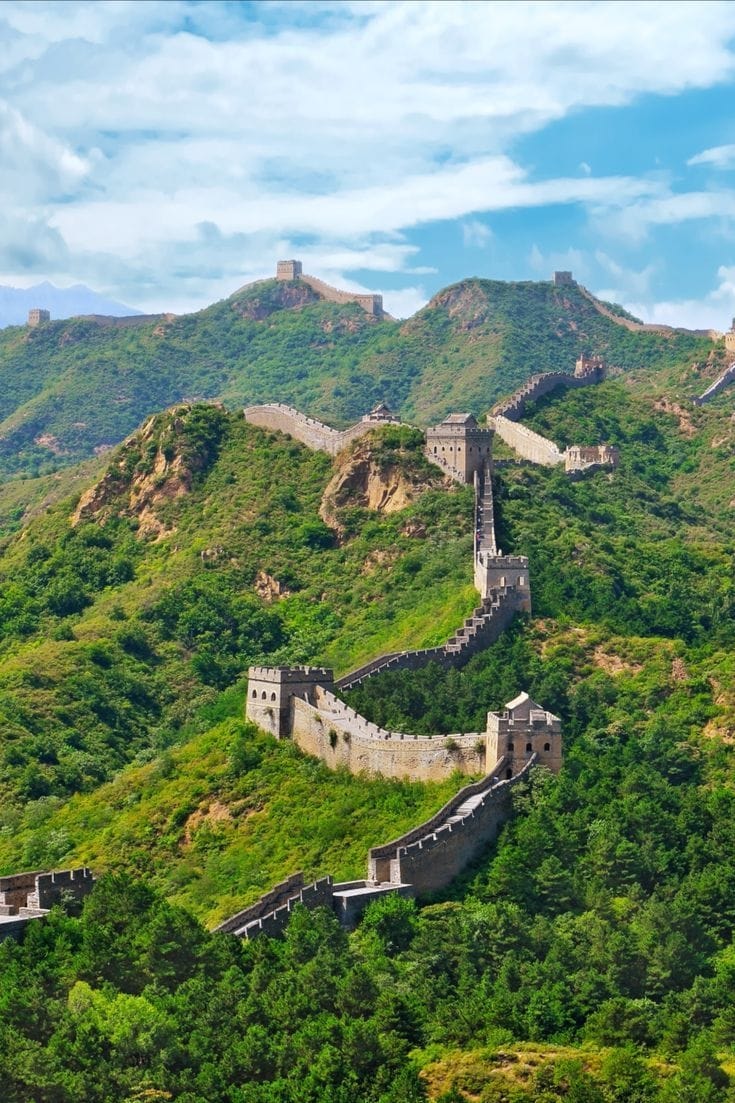 2Global Iconic Landmarks List
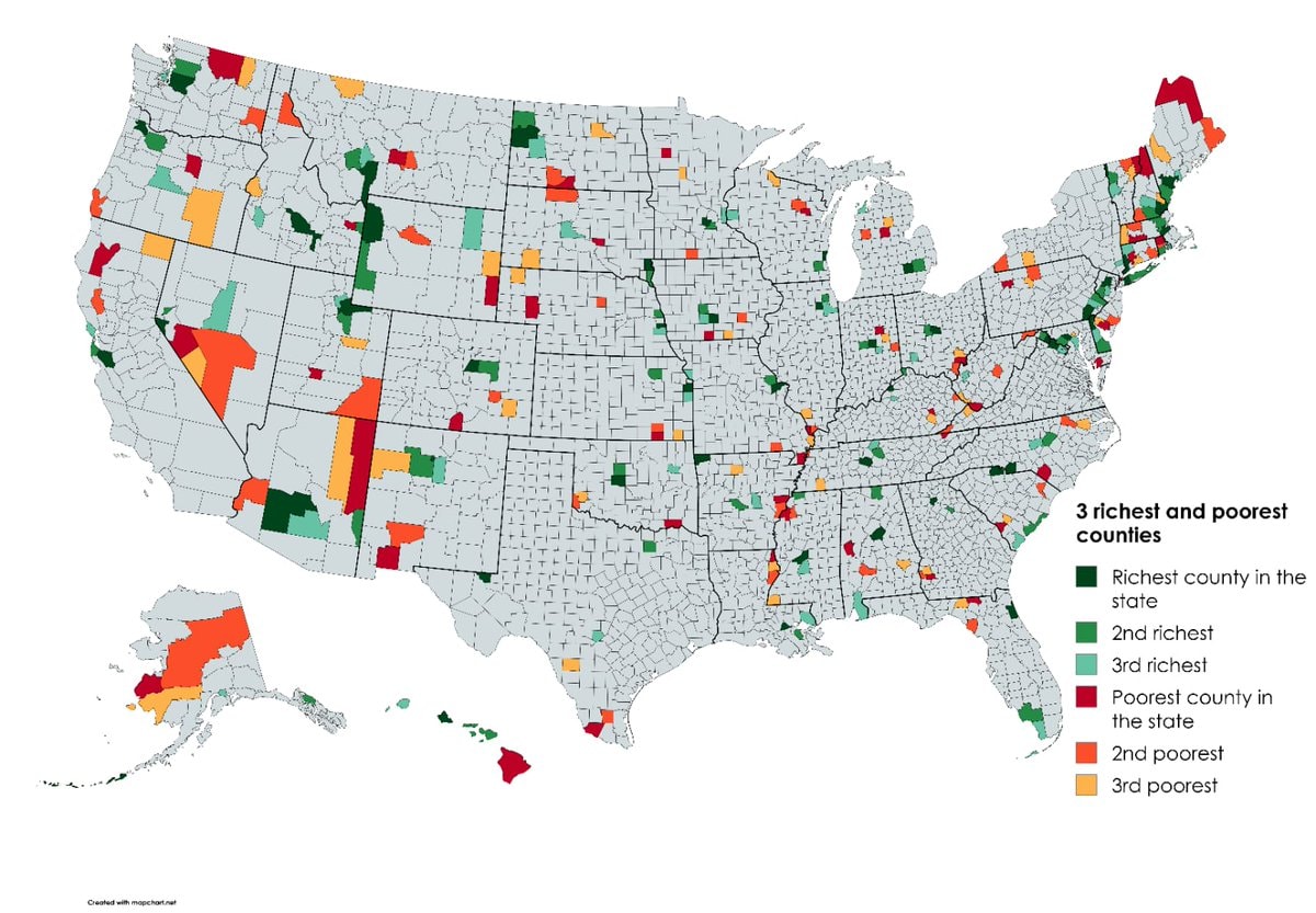 Richest and poorest US counties by state
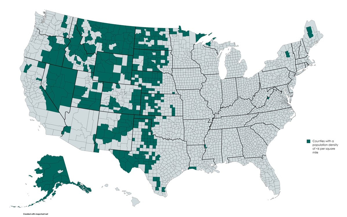 US counties under six people per square mile
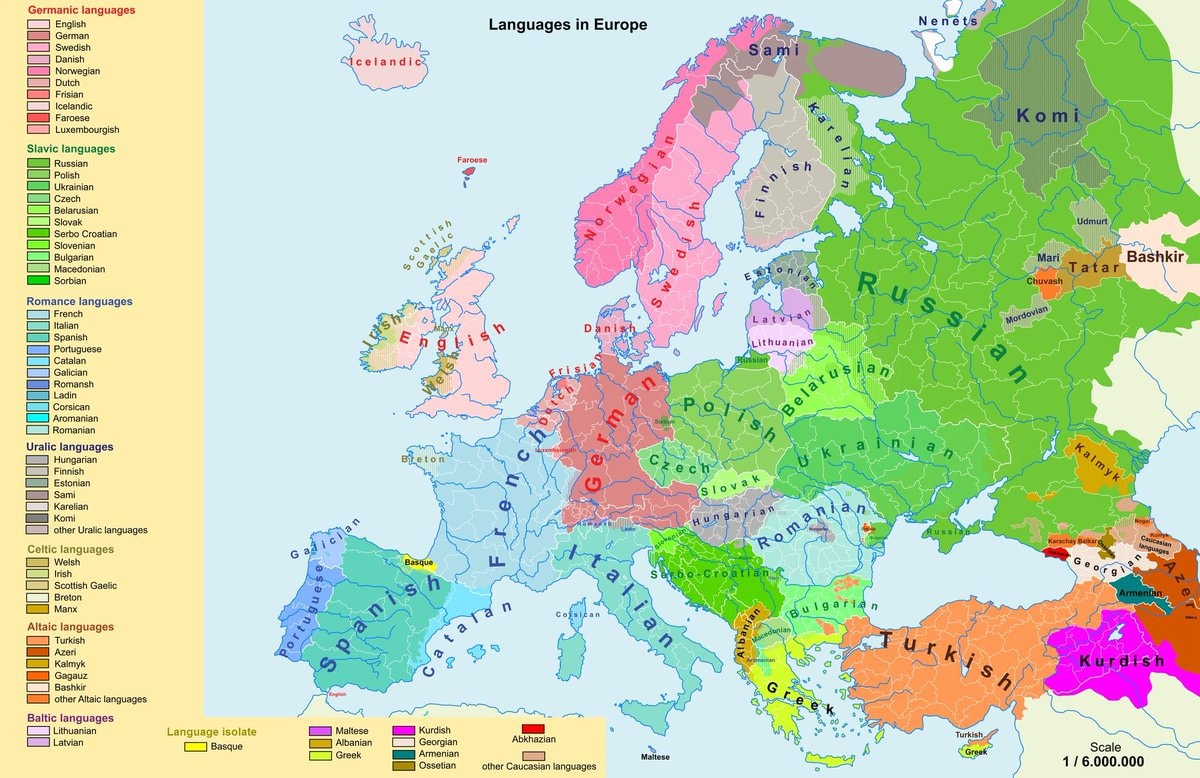 Linguistic map of Europe
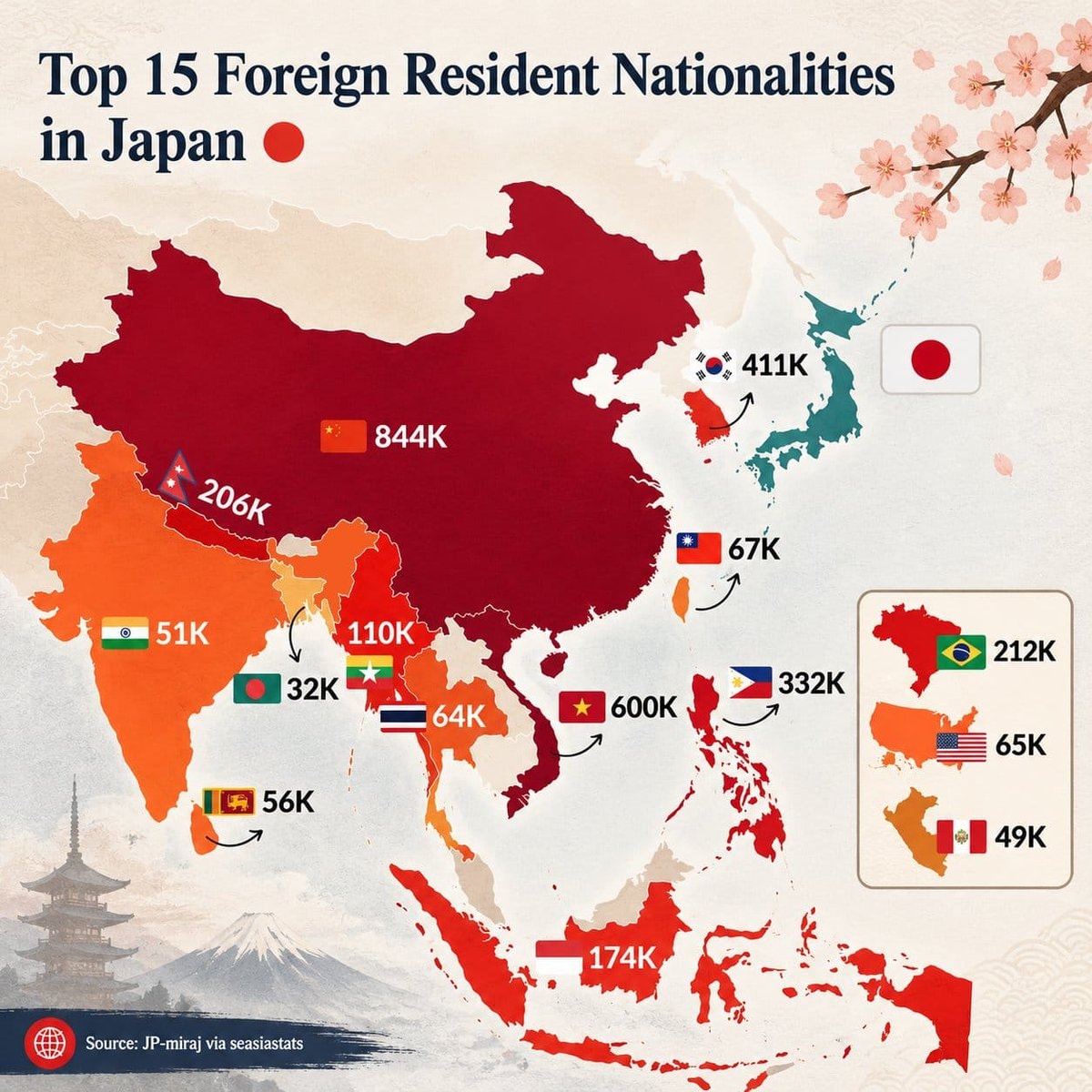 Top 15 Foreign Resident Nationalities in Japan
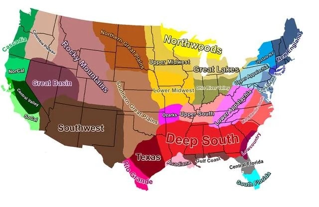 U.S. cultural regions map
@taikiRoman Empire organized by years of control with data broken down by region
View original postPhoto by @taiki· Sep 14, 2026· Info/Editorials
The image is a historical map showing the extent of the Roman Empire and its successor states across Europe, North Africa, and the Middle East. Different shades of purple indicate varying periods of control or influence, with numerical labels representing years. The map's style is educational and informative, with clear borders and numerical data overlaid on geographical features. The most notable visual element is the extensive territorial coverage depicted by the purple shading, highlighting the vast reach of Roman influence throughout history.
No comments yet. Be the first!
Most spoken language in MexicoU.S. states last vote for DemocratNations Mentioned in the Holy Bible2Global Iconic Landmarks ListRichest and poorest US counties by stateUS counties under six people per square mileLinguistic map of EuropeTop 15 Foreign Resident Nationalities in JapanU.S. cultural regions map
No comments yet. Be the first!