
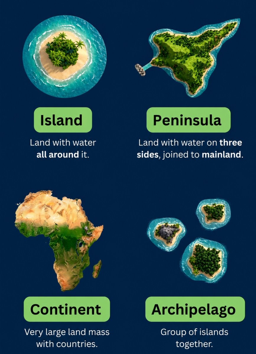
@scarlett_sThis infographic breaks down the four main landforms in a way that actually sticks. island, peninsula, continent, archipelago, simple definitions, clear visuals. good reference
View original post@scarlett_sThis infographic breaks down the four main landforms in a way that actually sticks. island, peninsula, continent, archipelago, simple definitions, clear visuals. good reference
View original postPhoto by @scarlett_s· Jul 28, 2026· Education
The image is an infographic with four distinct sections, each illustrating a geographical landform. The top left shows an island, the top right a peninsula, the bottom left the continent of Africa, and the bottom right an archipelago. The style is clean and educational, with vibrant, almost cartoonish renderings of the landmasses against a dark blue background. Each section has a green label and a brief definition below it. The definitions are: "Island: Land with water all around it.", "Peninsula: Land with water on three sides, joined to mainland.", "Continent: Very large land mass with countries.", and "Archipelago: Group of islands together."
 2Study on literacy scores by state
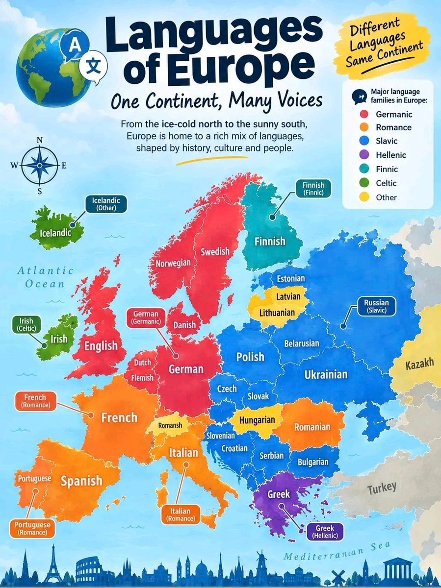 Languages of Europe infographic
 Gen Z trade salary view
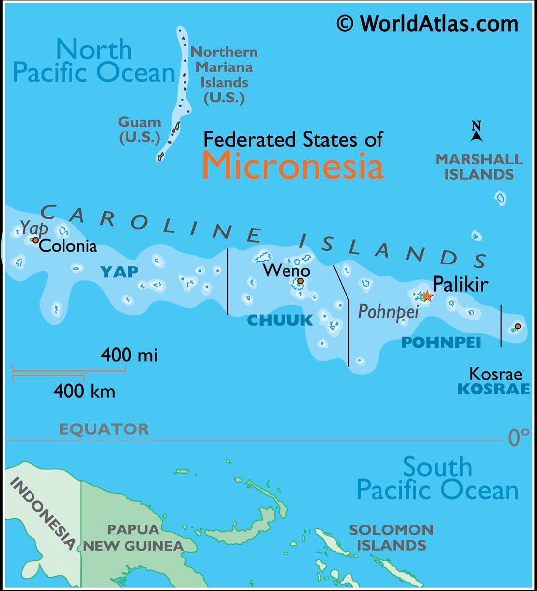 Micronesia map and facts
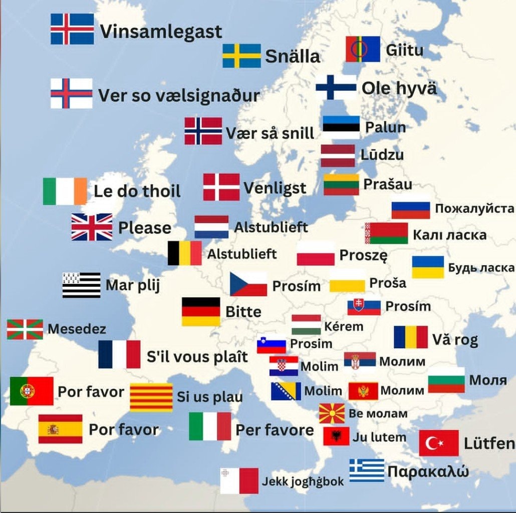 How to say Please in Europe
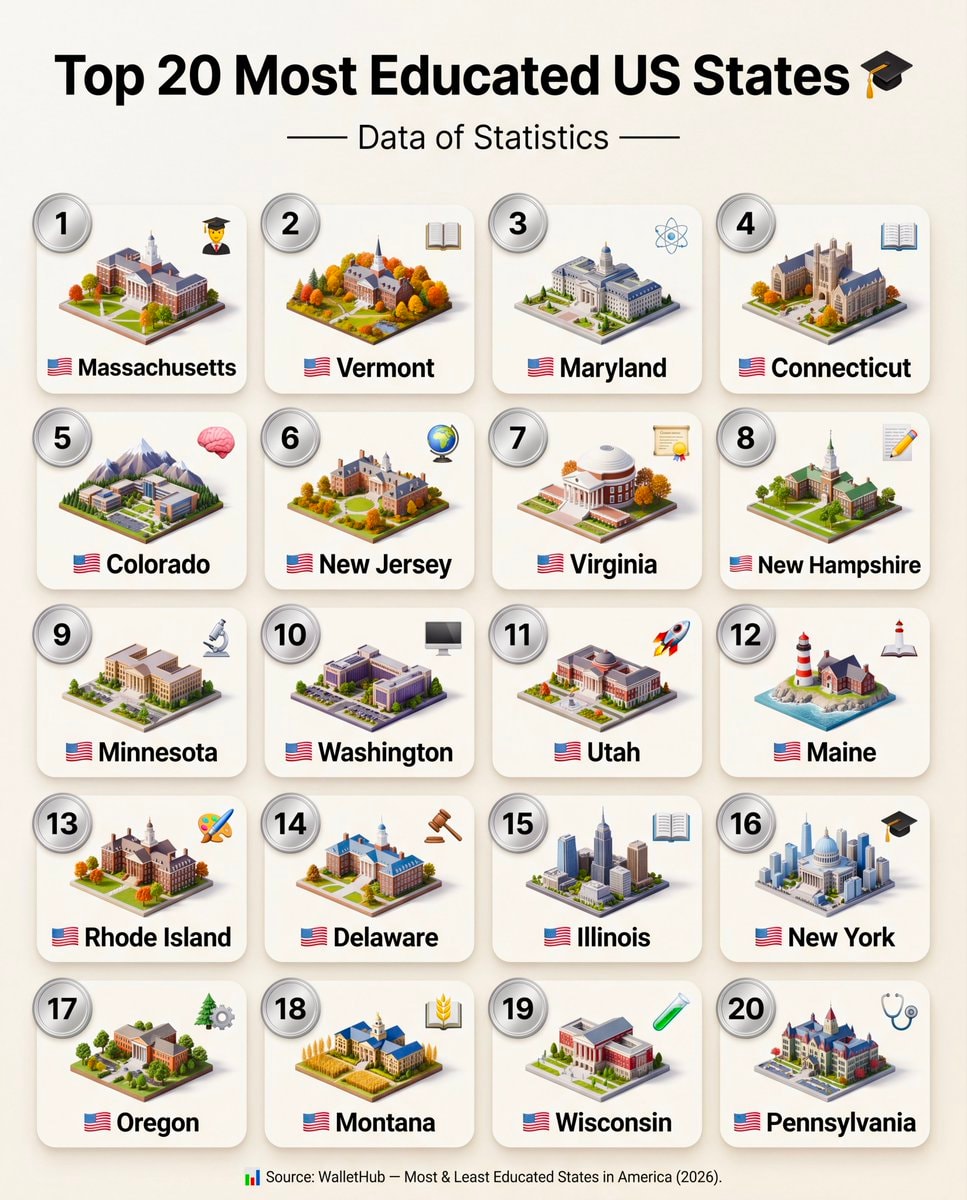 Top 20 Most Educated US States 2026
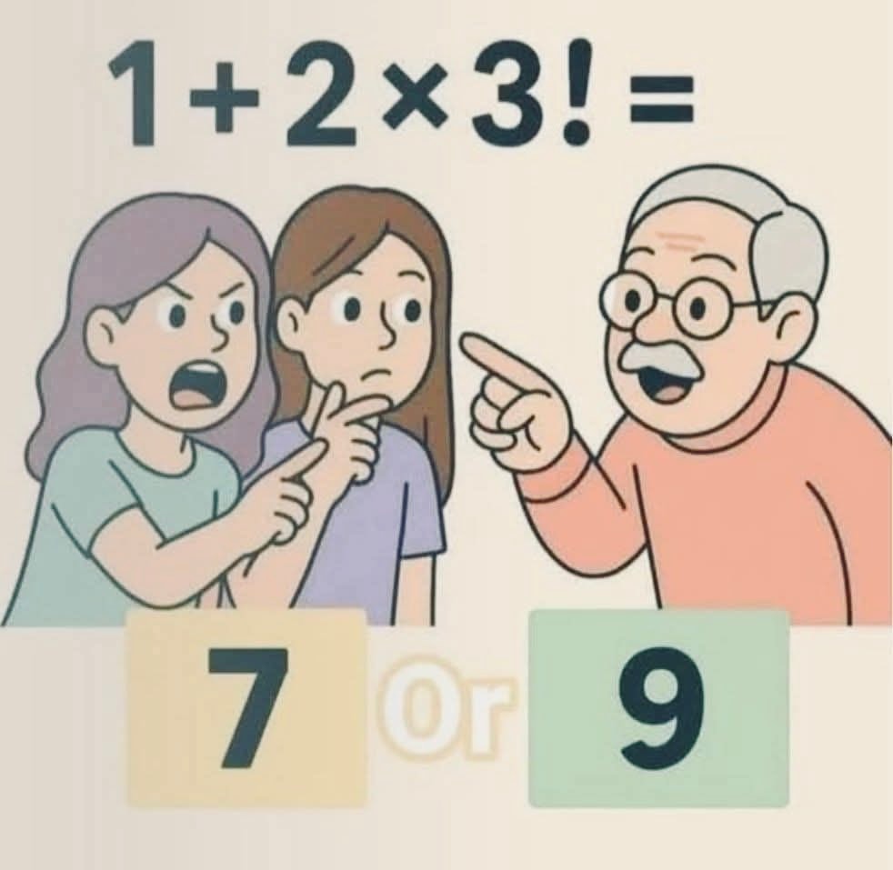 cartoon scene with three characters and a math problem
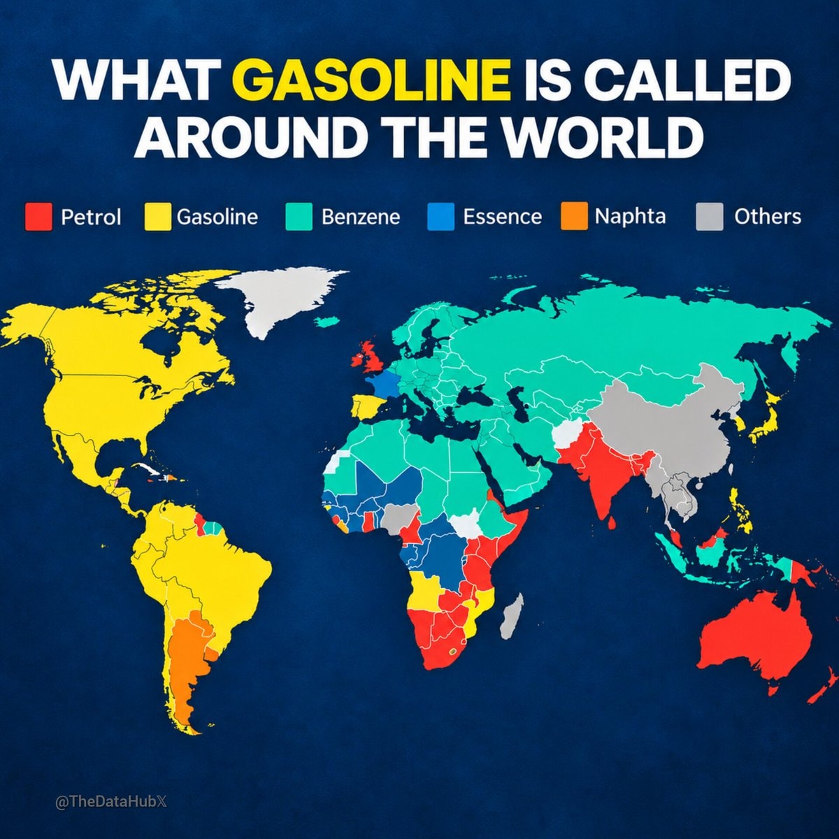 WHAT GASOLINE IS CALLED AROUND THE WORLD
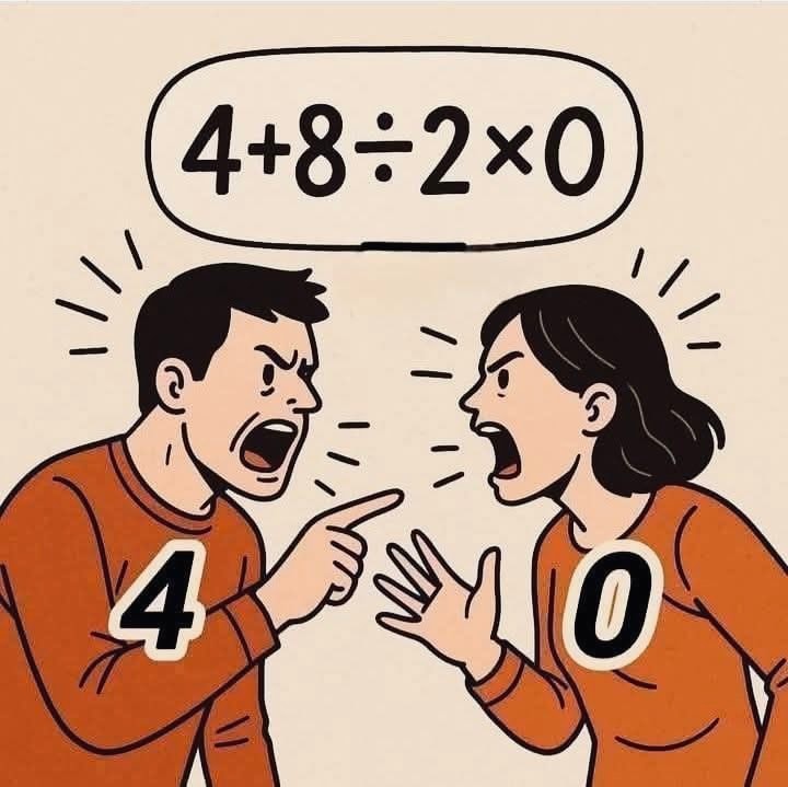 cartoon couple arguing
 SpaceXAI GrokBot course
 Walter Lewin on physics classes
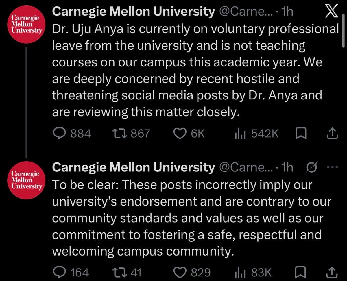 Carnegie Mellon University Dr. Uju Anya statement
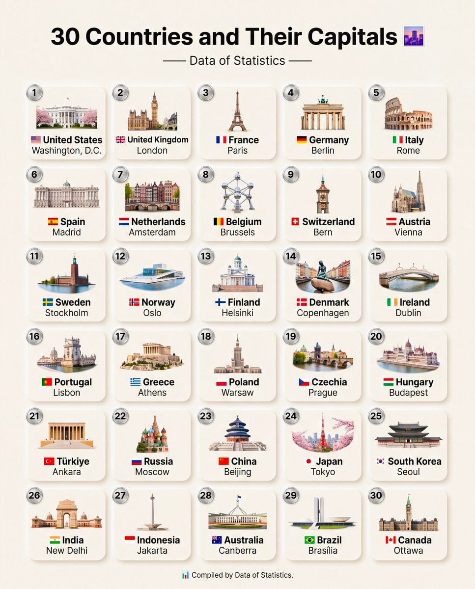 30 Countries And Their Capitals
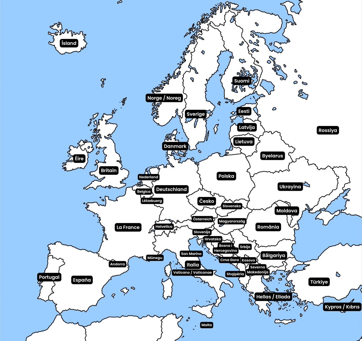 European country native names
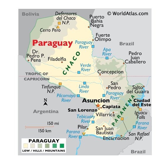 Paraguay maps and facts
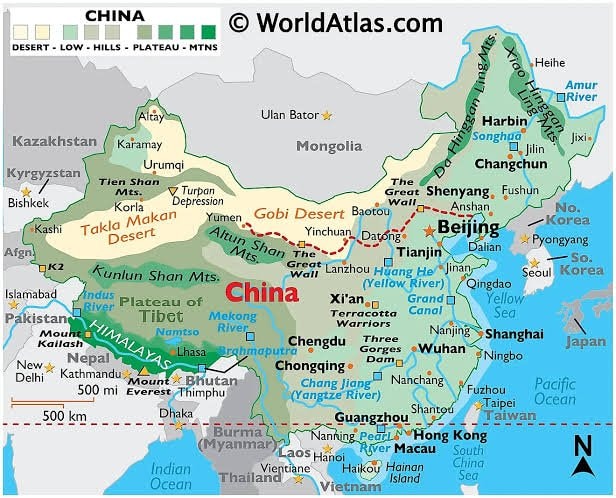 China Maps & Facts
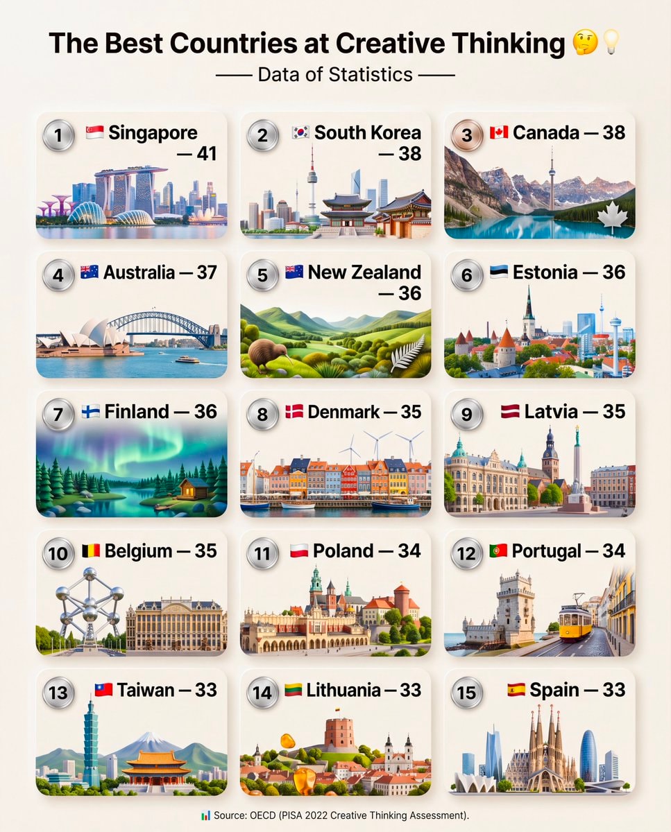 OECD PISA 2022 Creative Thinking Ranking
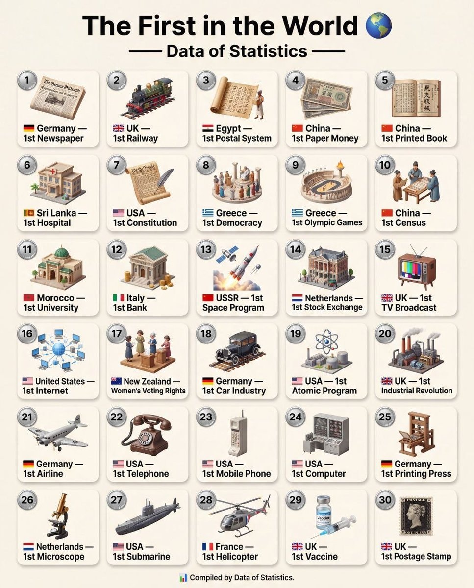 Global Historical Firsts Data of Statistics
@scarlett_sThis infographic breaks down the four main landforms in a way that actually sticks. island, peninsula, continent, archipelago, simple definitions, clear visuals. good reference
View original postPhoto by @scarlett_s· Jul 28, 2026· Education
The image is an infographic with four distinct sections, each illustrating a geographical landform. The top left shows an island, the top right a peninsula, the bottom left the continent of Africa, and the bottom right an archipelago. The style is clean and educational, with vibrant, almost cartoonish renderings of the landmasses against a dark blue background. Each section has a green label and a brief definition below it. The definitions are: "Island: Land with water all around it.", "Peninsula: Land with water on three sides, joined to mainland.", "Continent: Very large land mass with countries.", and "Archipelago: Group of islands together."
No comments yet. Be the first!
2Study on literacy scores by stateLanguages of Europe infographicGen Z trade salary viewMicronesia map and factsHow to say Please in EuropeTop 20 Most Educated US States 2026cartoon scene with three characters and a math problemWHAT GASOLINE IS CALLED AROUND THE WORLDcartoon couple arguingSpaceXAI GrokBot courseWalter Lewin on physics classesCarnegie Mellon University Dr. Uju Anya statement30 Countries And Their CapitalsEuropean country native namesParaguay maps and factsChina Maps & FactsOECD PISA 2022 Creative Thinking RankingGlobal Historical Firsts Data of Statistics
No comments yet. Be the first!