About this photo
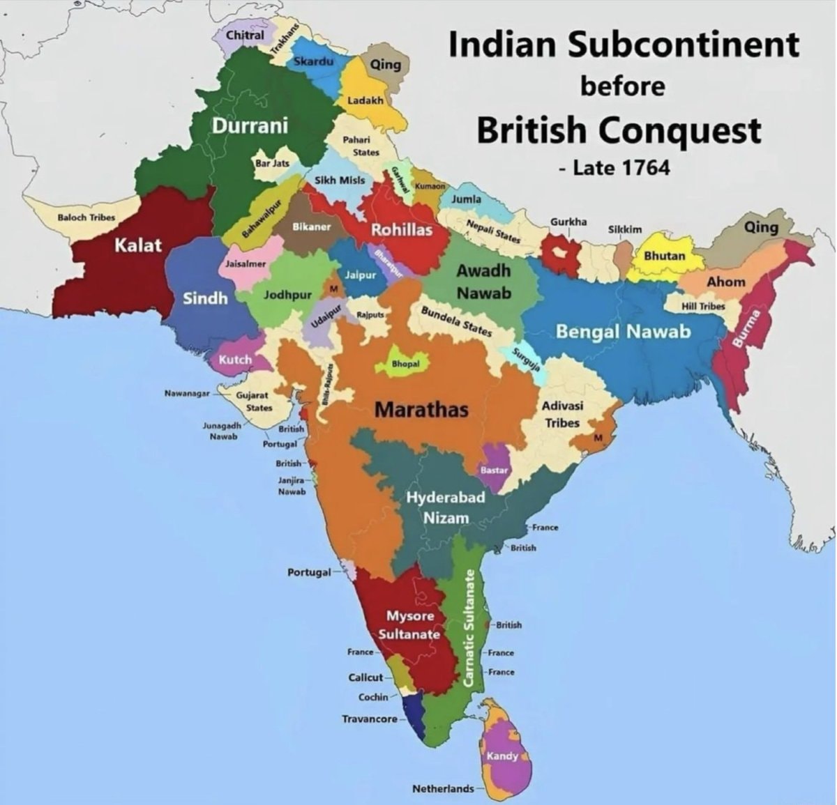
The image is a historical map of the Indian subcontinent. It shows various regions and kingdoms before the British conquest, specifically labeled as "Late 1764." The map uses different colors to delineate territories such as Durrani, Kalat, Sindh, Kutch, Marathas, Hyderabad Nizam, Mysore Sultanate, Bengal Nawab, and Awadh Nawab. The style is informational and educational, with clear labels for each region and some smaller territories. A notable detail is the presence of European colonial territories like British, Portuguese, French, and Netherlands marked on the map. The title "Indian Subcontinent before British Conquest - Late 1764" is prominently displayed at the top right.
















No comments yet. Be the first!